Khurram Wadee ✅ · @mkwadee
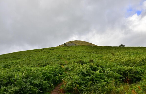
1490 followers · 14462 posts · Server mastodon.org.ukIn the afternoon of the first full day in #BannauBrycheiniog, we travelled to #Crickhowell or #Crughywel to climb #TableMountain, which is also the location of an #IronAge #fort. So, equipped with my #OrdnanceSurveyMap we made steady progress up the slopes, on #roads and then #footpaths, often across #farmland. The total walk was 12.5 km.
Approaching the summit, you can see that the area is covered with #ferns.
#MyWork #MyPhoto #CCBYSA #DSLR #Nikon #D7000 #Summer #Wales #OSMaps
#BannauBrycheiniog #crickhowell #crughywel #TableMountain #ironage #fort #ordnancesurveymap #roads #footpaths #farmland #ferns #mywork #myphoto #ccbysa #dslr #nikon #d7000 #summer #wales #OSMaps
Graham X White · @gxwhite
91 followers · 398 posts · Server mastodon.scotGood piece about the history of mapping the Scottish Highlands, and the social/environmental impacts of doing so. https://www.inkcapjournal.co.uk/how-the-ordnance-survey-shaped-the-scotland-we-see-today/
#OrdnanceSurveyMap
#Scotland
#Environment
#environment #scotland #ordnancesurveymap
LordWoolamaloo · @LordWoolamaloo
684 followers · 2111 posts · Server mastodon.scotThe tables in the house old, Victorian bar of Bennett's has old Ordnance Survey maps as table tops. By coincidence ours today covers the area of Edinburgh we're actually sitting in. Which is kind of nice.
#Edinburgh #Edimbourg #photography #BennetsBar #pub #OSMaps #OrdnanceSurveyMap
#ordnancesurveymap #osmaps #pub #bennetsbar #photography #edimbourg #edinburgh

