Trevor Caughlin · @trevorcaughlin
388 followers · 115 posts · Server ecoevo.socialwe've also published our open source workflow, which uses
@OpenDroneMap
for orthomosaic and structure-for-motion products: https://doi.org/10.7923/92HF-GP09 #opendronemap #uas #drone #orthomosaic #sfm
#opendronemap #uas #drone #orthomosaic #sfm

John Turnbull · @johnwturnbull
64 followers · 17 posts · Server ecoevo.social
View from the second wheelie towards the southernmost slab. #3D #orthomosaic #marineexplorer. Note how moving objects (kelp) are fragmented as their position changes from one image to the next. The orange on top of the bin is a blue-lined goatfish :)
#3d #orthomosaic #marineexplorer
John Turnbull · @johnwturnbull
64 followers · 14 posts · Server ecoevo.social
This series of 5 screen prints shows the potential of an #orthomosaic. 100 m of reef can be viewed in entirety, then drilled down to identify a single 5 cm nudibranch (C. amoenum) 1/3

geoObserver · @geoObserver
238 followers · 154 posts · Server mastodon.social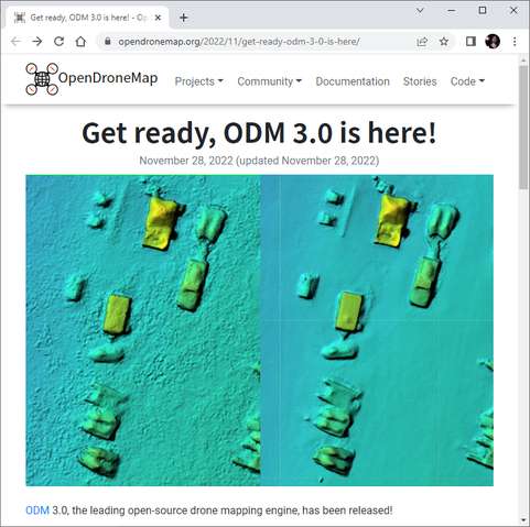
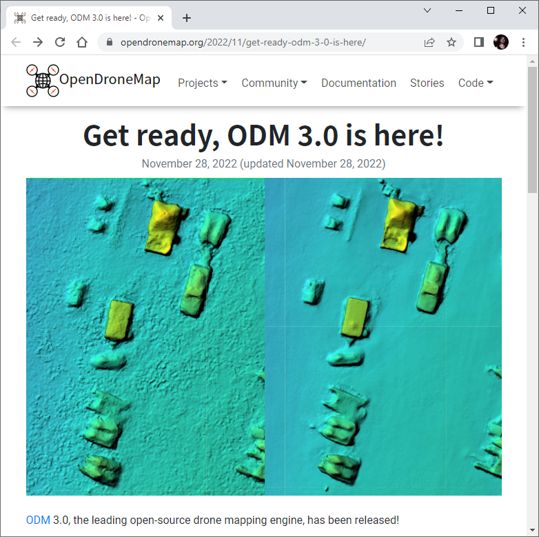
OpenDroneMap Released, jetzt v3.0 https://geoobserver.wordpress.com/2022/11/29/opendronemap-released-jetzt-v3-0/ via @berttemme @OpenDroneMap #WebODM #3d #pointcloud #3DModel #Orthomosaic #SurfaceModel #fossgis #foss4g #gistribe #opensource #spatial #geospatial #gis #geo #geoObserver
#WebODM #3d #pointcloud #3dmodel #orthomosaic #surfacemodel #fossgis #foss4g #gistribe #opensource #spatial #geospatial #gis #geo #geoobserver