Valerie Norton · @valhikes
65 followers · 200 posts · Server en.osm.town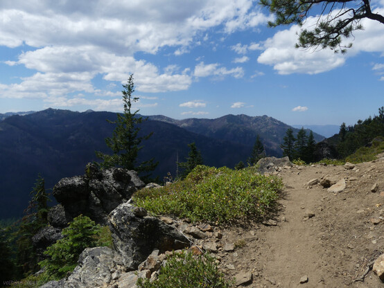
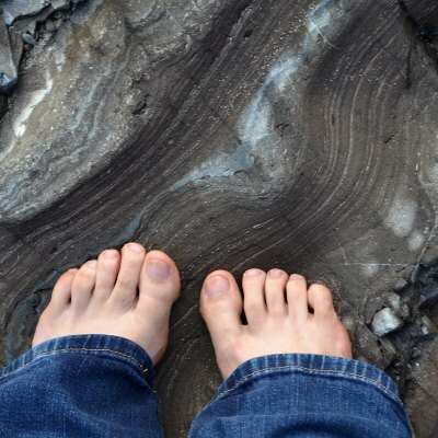
The #RussianWilderness. It's not very big, but packs a punch. I hadn't been and found my way from the south via the #PacificCrestTrail. For my 1st day of 3 #backpacking, one of the jewels of the area: Russian Lake.
The post is here: https://valhikes.blogspot.com/2023/08/russian-siphon-lake-russian-lake-and.html
#hiking #nature #landscape #travel #hike #outside #mountains #Califronia #KlamathNationalForest
#KlamathNF #RussianLake #SyphonLake #WaterdogLake #lake #randompond #butterfly #fish #SiskiyouCounty #publiclands #granite #PCT
#russianwilderness #pacificcresttrail #backpacking #hiking #nature #landscape #travel #hike #outside #mountains #califronia #klamathnationalforest #klamathnf #russianlake #syphonlake #waterdoglake #lake #randompond #butterfly #fish #siskiyoucounty #publiclands #granite #pct

AI6YR · @ai6yr
4503 followers · 29772 posts · Server m.ai6yr.org
Postholer · @postholer
19 followers · 61 posts · Server mapstodon.space
Tropical Storm/Hurricane #Hilary is on its way #PacificCrestTrail. #Campo and the #SoCal mountains may seem some serious rainfall: https://postholer.com/map/Pacific-Crest-Trail/28.110749/-111.972656/5/nexrad,stormtrack,meta
#hilary #pacificcresttrail #campo #socal #pct #jmt #hiking #GIS

Joseph Elfelt · @mappingsupport
472 followers · 395 posts · Server m.ai6yr.org
#PacificCrestTrail is closed in northern WA due to the #BlueLakeFire east of Rainey Pass.
To get the most benefit from the map see 2 links upper left corner.
#PCT #WAfire #WAwx.
Open #GISsurfer map:
https://mappingsupport.com/p2/gissurfer.php?center=48.496455,-120.688591&zoom=13&basemap=USA_basemap&overlay=VIIRS_7_day,MODIS_7_day,State_boundary,Fire_perimeter_NIFC&data=https://mappingsupport.com/p2/special_maps/disaster/USA_wildland_fire.txt
#pacificcresttrail #bluelakefire #pct #wafire #wawx #gissurfer

JDS · @jds
1184 followers · 4228 posts · Server sfba.social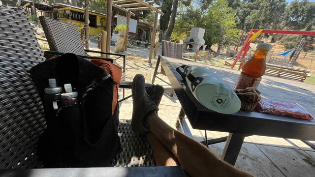
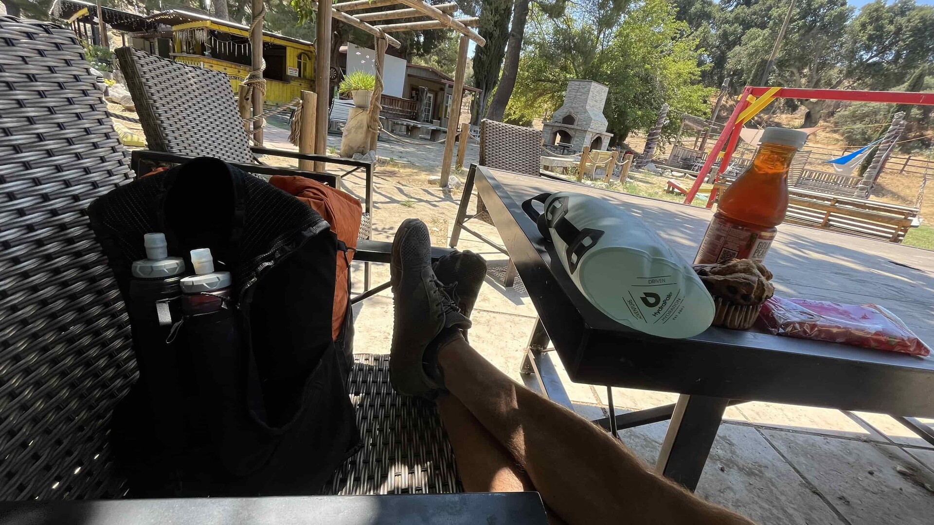
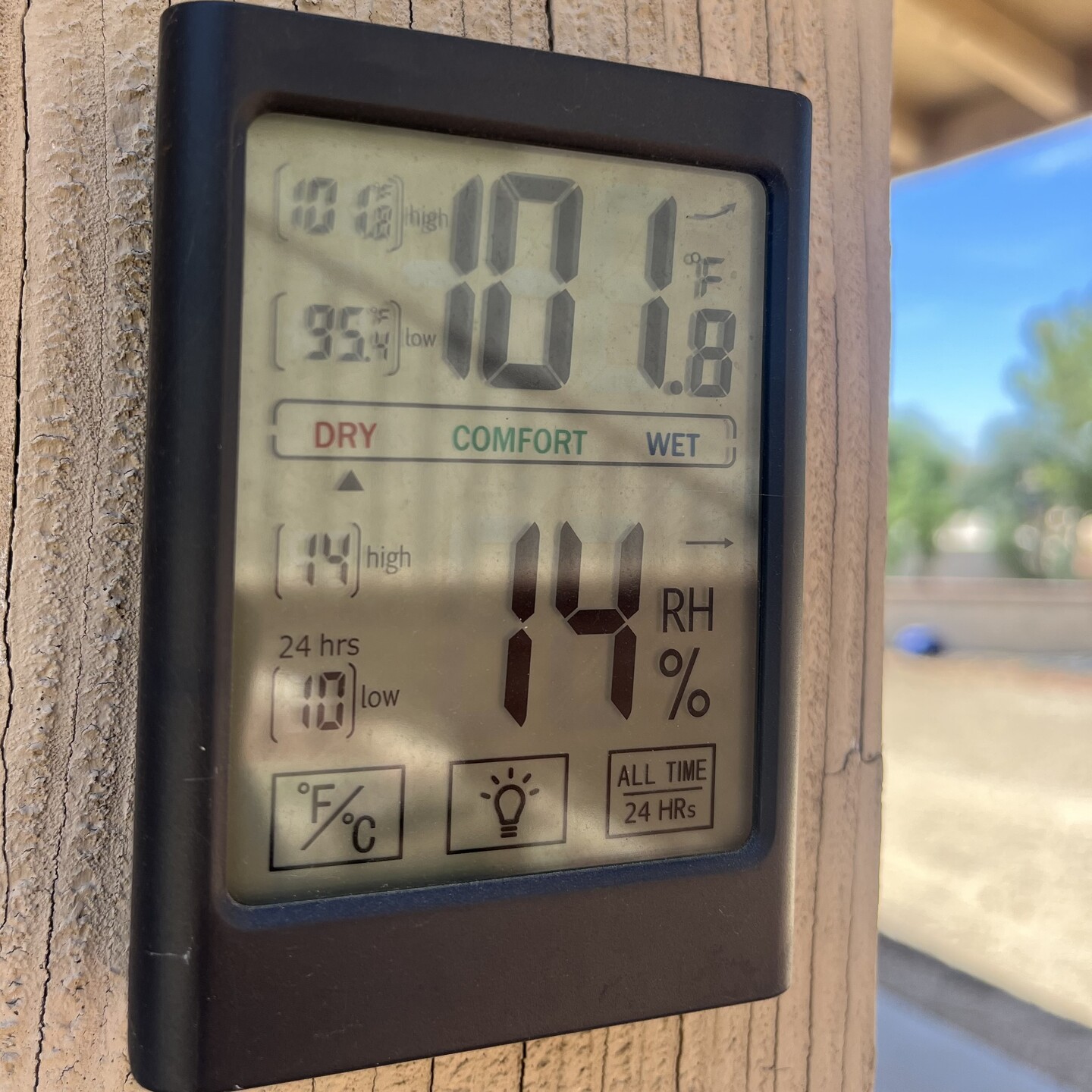
Took a break at the old KOA on the way back and then headed out into the hundred degree heat. Took a break at the cave again also to let the peak heat pass, heading home now.
#PacificCrestTrail #Hiking #Backpacking
#pacificcresttrail #hiking #backpacking
JDS · @jds
1182 followers · 4212 posts · Server sfba.social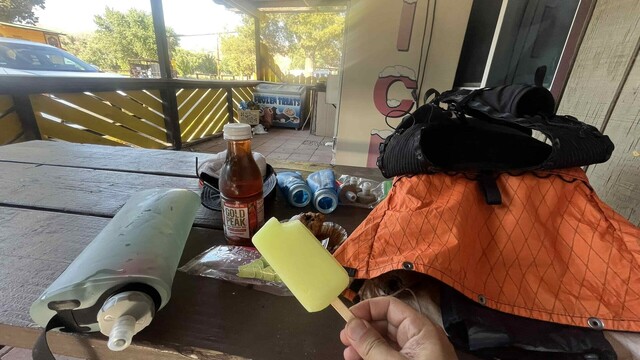
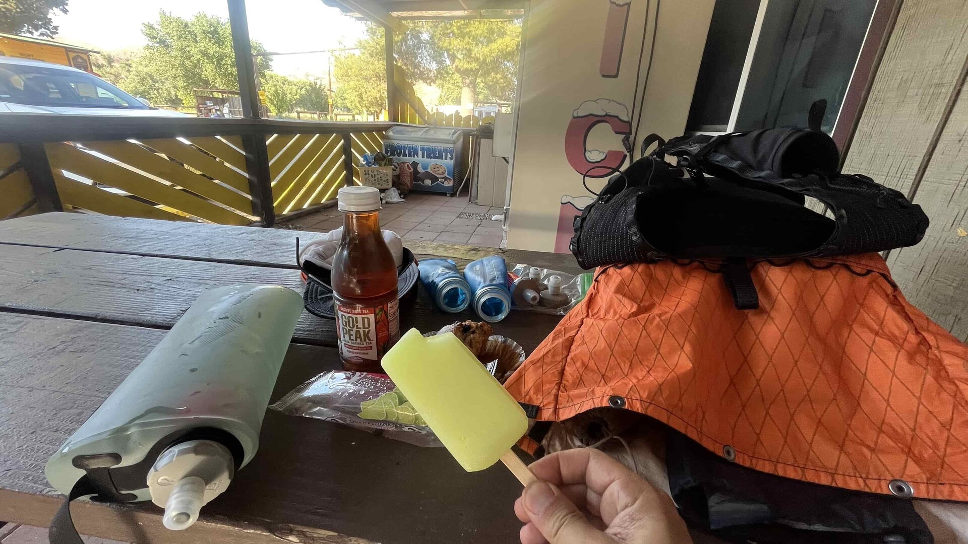
Good break at the old KOA campground. Amy in the shop treated me to a popsicle, yum. Filled up with water for the 8 mile climb to the ranger station up on the ridge.
#PacificCrestTrail #Hiking #Backpacking
#pacificcresttrail #hiking #backpacking
JDS · @jds
1182 followers · 4211 posts · Server sfba.social
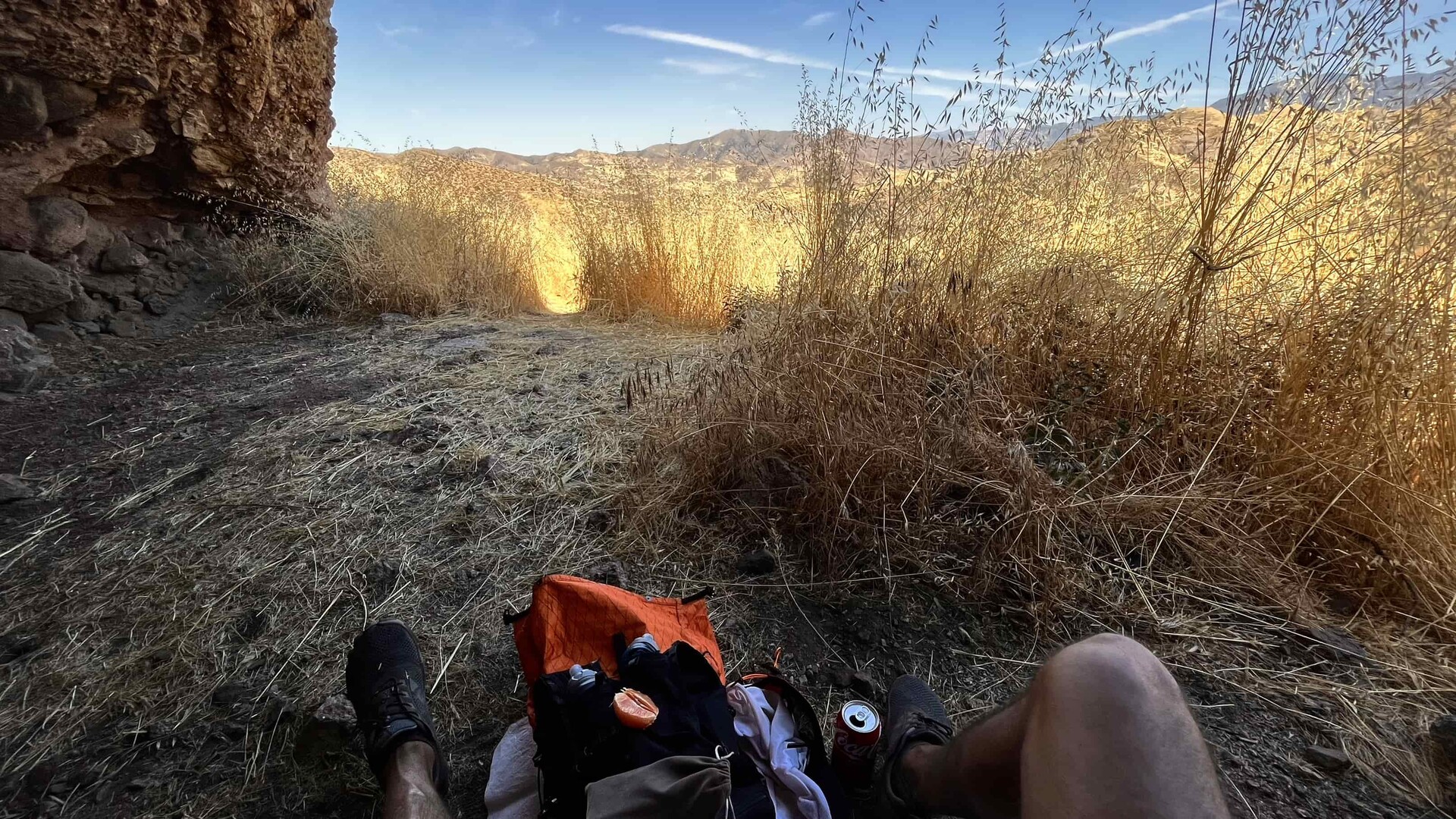
Taking a break at the cave. 5.5 miles done, the old KOA camp is 3.5 miles more and their shop is open another 4 hours.
#Hiking #Backpacking #PacificCrestTrail #HeatWave
#hiking #backpacking #pacificcresttrail #heatwave
JDS · @jds
1182 followers · 4209 posts · Server sfba.social
Calling it heat acclimation. Heading over the exposed hills to the old KOA campground, then fill up and continue south.
#PacificCrestTrail #Hiking #Backpacking #TrailRunning
#pacificcresttrail #hiking #backpacking #trailrunning
JDS · @jds
1175 followers · 4167 posts · Server sfba.social
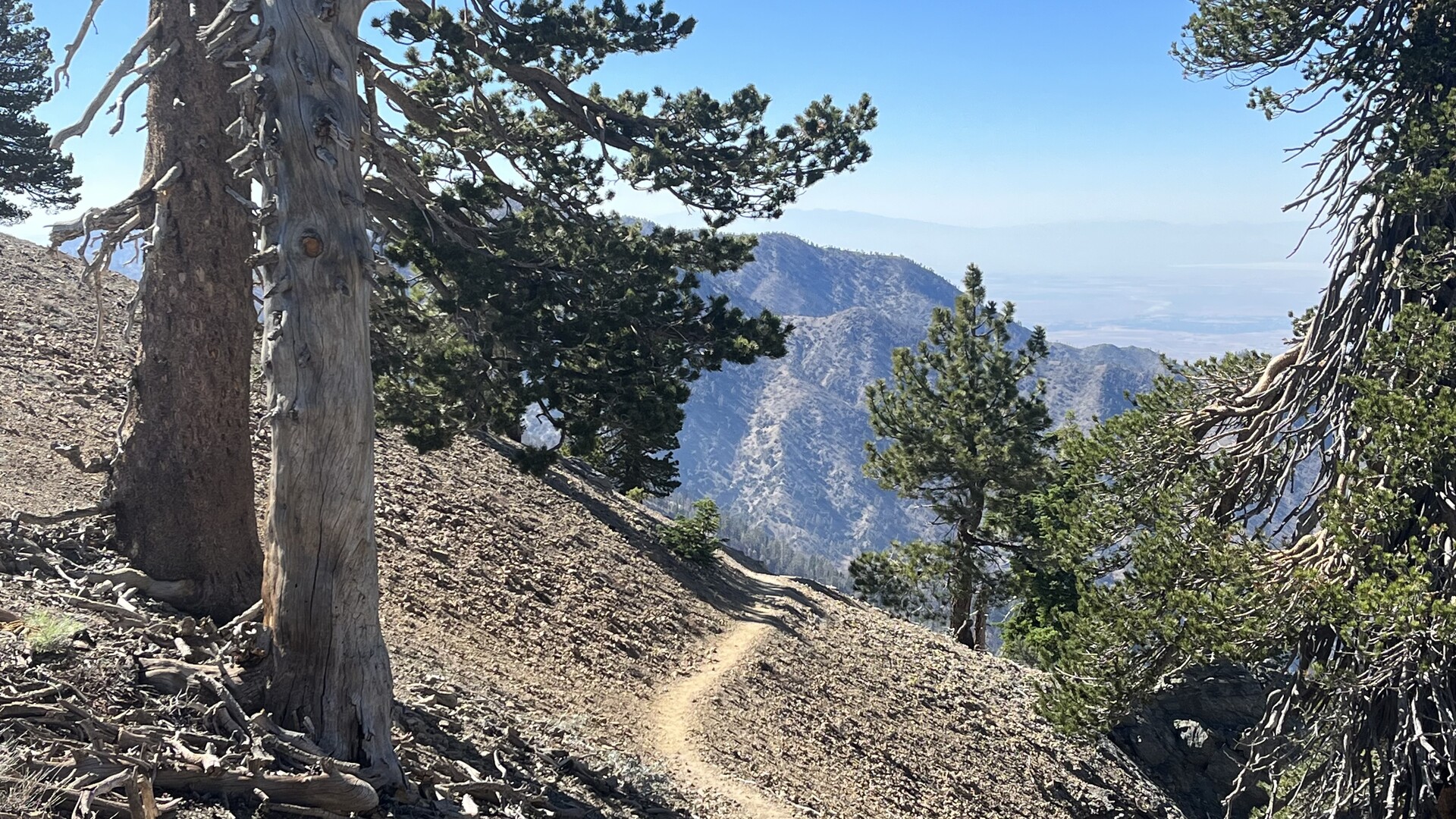
I love the San Gabriel mountains and the Angeles National forest. It’s LA’s best secret.
#PacificCrestTrail #TrailRunning #Hiking #California #Landscape
#pacificcresttrail #trailrunning #hiking #california #landscape
JDS · @jds
1175 followers · 4167 posts · Server sfba.social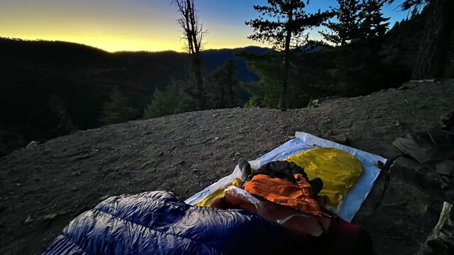
And a bit of sunrise color before it leapt over the horizon.
#Hiking #Backpacking #PacificCrestTrail
#hiking #backpacking #pacificcresttrail
JDS · @jds
1172 followers · 4143 posts · Server sfba.social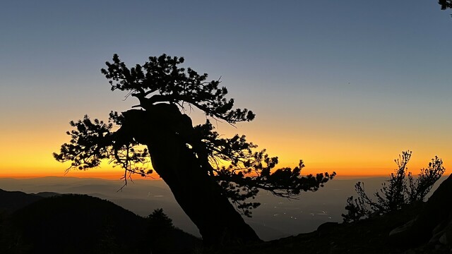
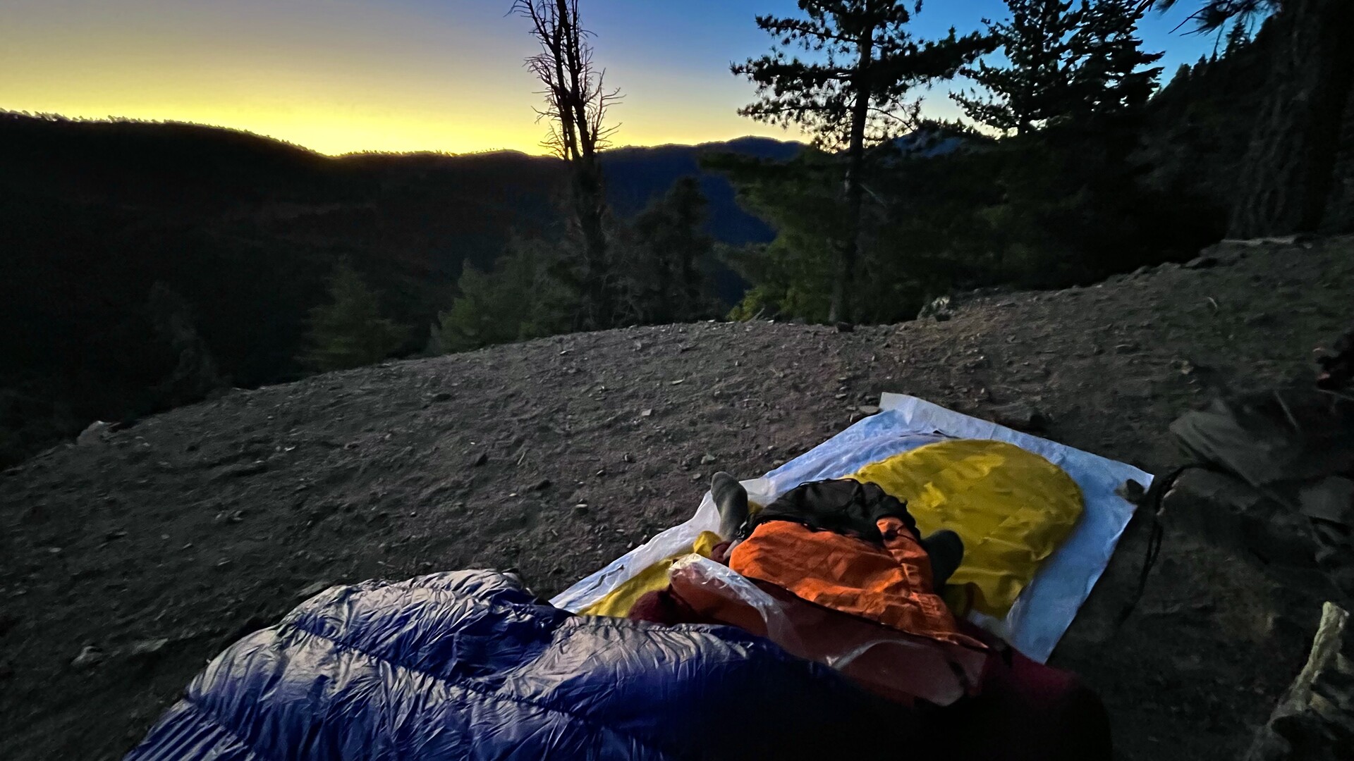
Lots of color at sunset last night.
#Sunset #Hiking #Backpacking #PacificCrestTrail
#sunset #hiking #backpacking #pacificcresttrail

GregCocks · @GregCocks
388 followers · 412 posts · Server techhub.socialPacific Crest Trail Viewshed [animation]
--
https://youtu.be/tmY27ZIVfpA <-- shared video
--
H/T Doug Newcombe
“This animation is a viewshed of the Pacific Crest Trail. A viewshed shows all surrounding terrain that is visible from a given point on the trail. The viewshed is taken at 1/10 of a mile increments. Visible terrain is light colored, invisible terrain is darker. Views are without regard for vegetation or tree cover…”
“The following viewsheds were created with GDAL, one tif for every tenth
of a mile along the 2,650 mile Pacific Crest Trail. Stitched together
with ffmpeg..”
#GIS #spatial #mapping #viewsheds #spatialanalysis #3D #elevation #Pacific #PNW #PacificCrestTrail #DEM #GDAL #ffmpeg #viewshed #animation #hiking #trail
#gis #spatial #mapping #viewsheds #spatialanalysis #3d #elevation #pacific #pnw #pacificcresttrail #dem #gdal #ffmpeg #viewshed #animation #hiking #trail
JDS · @jds
1170 followers · 4139 posts · Server sfba.social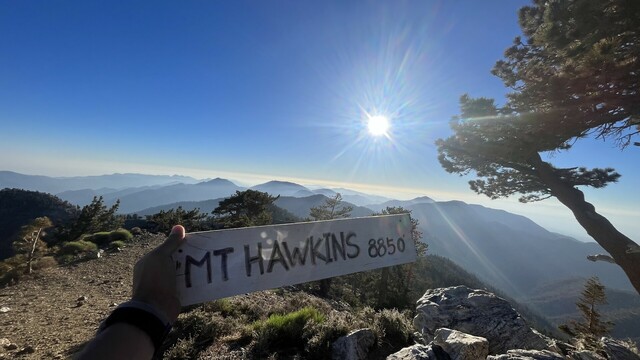
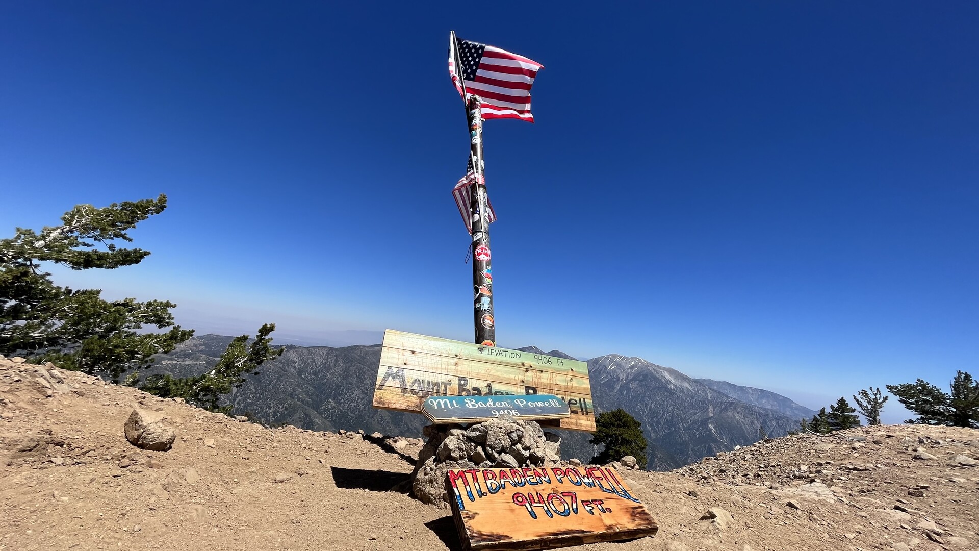
And the double up of the four pack. Back over Hawkins, Throop, Burnham, and Baden Powell.
#hiking #backpacking #pacificcresttrail #sunset
JDS · @jds
1169 followers · 4138 posts · Server sfba.social
San Gabriel 4 pack today. My favorite stretch of Southern California trail. Baden Powell, Burnham, Throop, Hawkins.
Then down to Little Jimmy Spring, and now back again.
#Hiking #Backpacking #PacificCrestTrail
#hiking #backpacking #pacificcresttrail

Lannan ⛈️ · @lannan
346 followers · 421 posts · Server mas.to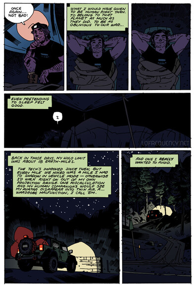
I know I mostly do original art, but I'll always be proud of the #Transformers #fancomic I did a few years back too 🥰
#comics #ComicArt #ArtistsOnMastodon #NatureArt #California #PacificCrestTrail
#pacificcresttrail #california #natureart #artistsonmastodon #comicart #comics #fancomic #transformers

Ranger Dan · @rangerdan
207 followers · 747 posts · Server sfba.social
@douglasvb @ai6yr thanks for the tip. I will flying over that area on Sunday but we have some warm months to go before we hike. But will definitely have some back-up plans. #TrinityAlps is always a good one. They had a ton of snow this year also but melting quicker than the Sierra. Though a freid who lives in Truckee says it is melting fast! #PCT #PacificCrestTrail
#trinityalps #pct #pacificcresttrail
PCTWX · @pctwx
13 followers · 158 posts · Server masto.aiLassen NP/Belden CA: ...A strong thunderstorm will impact portions of east central Shasta and northwestern Lassen Counties through 1015 PM PDT... At 912 PM PDT, Doppler radar was tracking a strong thunderstorm 7 miles southeast of Fall River Mills, or 15 miles southwest of Nubieber, moving southwest at 15 mph. HAZARD...Winds in excess of 30 mph and half inch hail. http://dlvr.it/SqZzFl #PacificCrestTrail
PCTWX · @pctwx
13 followers · 157 posts · Server masto.aiLassen NP/Belden CA: ...Strong thunderstorms will impact portions of northwestern Plumas, northeastern Tehama and southeastern Shasta Counties through 900 PM PDT... At 805 PM PDT, Doppler radar was tracking strong thunderstorms along a line extending from 7 miles southeast of Cassel to near Old Station to 10 miles east of Lassen National Park. Movement was west at 20 http://dlvr.it/SqZtVc #PacificCrestTrail
PCTWX · @pctwx
13 followers · 156 posts · Server masto.aiLassen NP/Belden CA: ...A strong thunderstorm will impact portions of east central Tehama County through 645 PM PDT... At 619 PM PDT, Doppler radar was tracking a strong thunderstorm 8 miles southeast of Lyonsville, or 11 miles south of Mineral, moving southwest at 10 mph. HAZARD...Winds in excess of 30 mph and half inch hail. http://dlvr.it/SqZlhc #PacificCrestTrail
PCTWX · @pctwx
13 followers · 161 posts · Server masto.aiLassen NP/Belden CA: ...A strong thunderstorm will impact portions of west central Plumas, east central Tehama and north central Butte Counties through 630 PM PDT... At 539 PM PDT, Doppler radar was tracking a strong thunderstorm near Stirling City, or 12 miles north of Pulga, moving west at 10 mph. HAZARD...Winds in excess of 30 mph and half inch hail. http://dlvr.it/SqWvB8 #PacificCrestTrail