
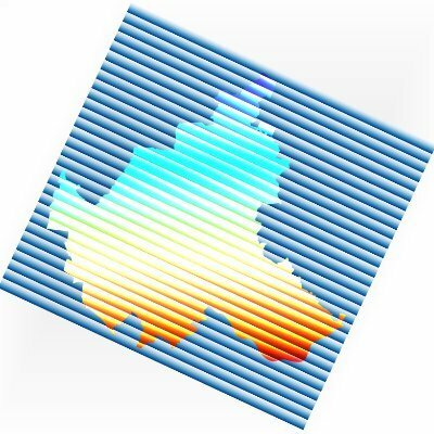
Mattia Bunel · @mattiabunel
167 followers · 29 posts · Server framapiaf.orgQuatrième intervention: Tile & merge: Distributed #delaunay triangulations for cloud computing, par Laurent Caraffa (IGN, UMR LaSTIG), Mathieu Brédif #pointcloud #Spark

Hans van der Kwast · @hansakwast
480 followers · 147 posts · Server fosstodon.org
Have you already registered for the #FOSS4GNL 2023 conference on 13 & 14 September in Middelburg?
There are workshops and presentations in Dutch & English. I'll give a workshop on the latest #pointcloud processing tools in :qgis:. Programme & registration: https://foss4g.nl @qgisnl #OSGeoNL #FOSS4G #PDAL
#foss4gnl #pointcloud #OSGeoNL #foss4g #pdal
Hans van der Kwast · @hansakwast
463 followers · 134 posts · Server fosstodon.orgNice news item at @nhnieuws about research on cold air pools in dune slacks by #ihedelft MSc thesis student @JonasNegusse and Pieter Bliek. Cool to see the AHN4 #pointcloud visualisation in #qgis in the video! https://www.nhnieuws.nl/nieuws/323447/van-fascinatie-tot-wetenschappelijk-onderzoek-doorbraak-voor-alkmaarse-vrieskoujager

asmaloney (Andy) 🌎 · @asmaloney
22 followers · 293 posts · Server fosstodon.org
I released libE57Format v3.0.2 to fix a small issue with standards conformance, some build issues 🏗️, and reading index packets 📇.
If you need to work with E57 point cloud files, check it out!
(E57 is an ASTM standard for vendor-neutral point cloud data files.)
https://github.com/asmaloney/libE57Format/releases/tag/v3.0.2
#E57 #PointCloud #3D #GIS #Geospatial #LiDAR #FileFormat #cpp #OpenSource #FOSS
#e57 #pointcloud #3d #gis #geospatial #lidar #fileformat #cpp #opensource #foss
Hans van der Kwast · @hansakwast
436 followers · 116 posts · Server fosstodon.org
On 13 & 14 September 2023 #osgeonl is organising #foss4gnl in Middelburg. On 13 September there are workshops and I'll give one in English & Dutch on #pointcloud processing with #QGIS and #PDAL wrench. More info and registration: https://foss4g.nl
#foss4g
#OSGeoNL #foss4gnl #pointcloud #qgis #pdal #foss4g

GregCocks · @GregCocks
453 followers · 459 posts · Server techhub.social
What Is The Difference Between LiDAR Data And A Digital Elevation Model (DEM)? | What is 3DEP?
--
https://www.usgs.gov/faqs/what-difference-between-lidar-data-and-digital-elevation-model-dem <-- shared technical article 1
--
https://www.usgs.gov/3d-elevation-program/what-3dep <-- shared technical article 2
--
#GIS #spatial #mapping #opendata #LiDAR #DEM #elevation #3DEP #spatialdata #USA #IfSAR #radar #digitalterrain #DTM #dataresources #pointcloud #groundelevation
@usgs
#gis #spatial #mapping #opendata #lidar #dem #elevation #3dep #spatialdata #USA #ifsar #radar #digitalterrain #dtm #dataresources #pointcloud #groundelevation
Hans van der Kwast · @hansakwast
427 followers · 112 posts · Server fosstodon.org
New video: easily tile and retile #pointcloud layers in #QGIS using the new point cloud processing tools in QGIS 3.32 Lima. https://youtu.be/mRMD0YNcNFQ

Qiita - 人気の記事 · @qiita
22 followers · 756 posts · Server rss-mstdn.studiofreesia.comQGIS3.32を利用してLASからCOPCとSTAC仕様に基づいたVirtual Point Clouds(仮想点群)を生成する
https://qiita.com/nokonoko_1203/items/c6e2f47da74f92ec3666?utm_campaign=popular_items&utm_medium=feed&utm_source=popular_items
#qiita #vpc #QGIS #PointCloud #STAC
#qiita #vpc #qgis #pointcloud #stac
Hans van der Kwast · @hansakwast
407 followers · 97 posts · Server fosstodon.orgNew video: Create and Use Virtual Point Clouds (VPC) in #QGIS. Nice to have these new native #pointcloud tools in QGIS 3.32 Lima! https://youtu.be/lGioykDOg3k

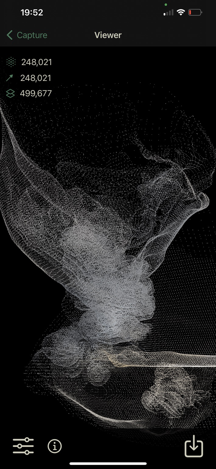
Christopher Remde · @ratdaddy
3 followers · 1 posts · Server graphics.socialUnity Geometry Sequence Streaming
is a package I just released for #unity3d , which allows you to stream large, animated, #pointcloud and #mesh #sequences from disk. Supports Timeline, scriptable playback and is highly performant, using the Jobs system.
https://buildingvolumes.github.io/Unity_Geometry_Sequence_Streaming/
#unity3d #pointcloud #mesh #sequences
· @cartocalypse
526 followers · 573 posts · Server norden.socialAny idea why RGB does not work with https://viewer.copc.io/?resources=https://hannes.enjoys.it/copc/DOM1_XYZ_HH_2020_04_30-colored.copc.laz #copc #pointcloud #laz

BNHR.XYZ :tux: :qgis: · @bnhrdotxyz
55 followers · 42 posts · Server fosstodon.orgHow about you, what are you most excited about in QGIS 3.32?
You can read the changelog at https://changelog.qgis.org/en/qgis/version/3.32/ or watch it at https://www.youtube.com/watch?v=ZtE1Az-zpf0
#QGIS #GIS #FOSS #FOSS4G #GISChat #PointCloud #Lidar #VectorTiles
#qgis #gis #foss #foss4g #gischat #pointcloud #lidar #vectortiles
BNHR.XYZ :tux: :qgis: · @bnhrdotxyz
55 followers · 42 posts · Server fosstodon.orgThis feature was developed through a joint crowdfunding campaign by Lutra Consulting, North Road, and Hobu with the help of the community (BNHR being one of the many supporters of this crowdfunding campaign).
Other notable features in this release include:
- Map tip previews
- Annotation improvements
- Links in map exports
- Download vector tiles algorithm
- User profile selector
- Thread management in algorithm settings
#QGIS #GIS #FOSS #FOSS4G #GISChat #PointCloud #Lidar #VectorTiles
#qgis #gis #foss #foss4g #gischat #pointcloud #lidar #vectortiles

Anita Graser 🇪🇺🇺🇦 · @underdarkGIS
2260 followers · 1607 posts · Server fosstodon.orgThe new #QGIS :qgis: changelog video is up: tons of exciting features in different areas and for a variety of use cases, including editing and #cad like construction, #pointcloud, #python :python: console, processing toolbox, print layouts 🗺, and more
#qgis #cad #pointcloud #python #gischat #osgeo #gis #geospatial

· @justgord
9 followers · 103 posts · Server hachyderm.ioI put up some samples of planar meshes auto-generated from point clouds : quato.xyz using a new approach.
#lidar #pointcloud #mesh #photogrammetry
I see typically 30-50x smaller data size - view in 3D on web, download the .obj, and compare with original source datasets.
#lidar #pointcloud #mesh #photogrammetry

Jeremy Garniaux · @jeremy
1648 followers · 2023 posts · Server mapstodon.spaceAm I the only one not able to open LAS/LAZ files in :qgis QGIS 3.30 under Ubuntu 22.10?
It seems like it's not buit with pdal. Weird.
I tried to purge and reinstall it but without success 🤔
#lidar #qgis #pointcloud

· @BBC1MusicBot
28 followers · 39438 posts · Server mastodonapp.uk
🔊 #NowPlaying on BBCRadio1's #WindDownPresents
Pointcloud:
🎵 Sparks
#nowplaying #winddownpresents #bbcr1 #pointcloud

swhic · @swhic
6 followers · 12 posts · Server sonomu.club
· @BBC1MusicBot
19 followers · 30033 posts · Server mastodonapp.uk
🔊 #NowPlaying on BBCRadio1's #WindDownPresents
Pointcloud:
🎵 Sparks
#nowplaying #winddownpresents #bbcr1 #pointcloud

GeekProjects News · @news
4 followers · 3116 posts · Server geekprojects.com
3D Scanning a Room With a Steam Deck And a Kinect https://hackaday.com/2023/04/24/3d-scanning-a-room-with-a-steam-deck-and-a-kinect/ #PeripheralsHacks #handheldshacks #3dscanning #pointcloud #steamdeck #RTAB-map #Kinect
#PeripheralsHacks #handheldshacks #3dscanning #pointcloud #steamdeck #rtab #kinect