
SK53 · @SK53
133 followers · 484 posts · Server en.osm.town
Looking at ONS UPRN assignment to postcodes in inner city Coventry (postcode sector CV2 4) and noticing a few errors anomalies:
1. a few UPRNs well outside the basic area of the sector (all appear to be historical)
2. misplaced UPRNs, such as this one for 44 Roman Road (UPRN 100070694394)
#uprn #officeofnationalstatistics #postcodes

Ben Hamilton · @benhamilton
22 followers · 130 posts · Server pkm.socialWorking with Australian and New Zealand address data? check out Matthew Proctor's database of AU & NZ Postcodes. https://matthewproctor.com/australian_postcodes #australia #NewZealand #PostCodes
#australia #newzealand #postcodes
SK53 · @SK53
99 followers · 307 posts · Server en.osm.town
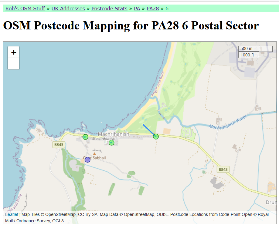
Browsing rjw62's Mathmos QA site (https://osm.mathmos.net/addresses/pc-stats/PA/PA28/6/) I noticed an OSM postcode centroid for Machrihanish village was oddly displaced. Turns out this is because of a golf course tagged with an address.
This is a classic example of a mismatch between physical & postal addresses (the postal address is in the village as one might expect), and the actual clubhouse on the course has a different postcode.
#OpenStreetMap #addresses #postcodes #postalAddress #PhysicalAddress
#OpenStreetMap #addresses #postcodes #postaladdress #physicaladdress

datamaps :rickwhoah: · @datamaps
350 followers · 490 posts · Server social.linux.pizza
Version 2 with 7,264 polygons (#MSOA #Census small areas in #England and #Wales) and 1,531,286 points (active #postcodes in EW)
it's a loop over all MSOAs, considering only points and neighbors (using #rstats {spdep}) of one MSOA at a time, then binding
steadiliy below 3GB RAM, it's less than a second for most, with the occasional longer, in 10 mins it got beyond 1K polygons
with so many points it's possible there'll be some probs with intersections, to be dealt with afterwards
#msoa #census #england #wales #postcodes #rstats