SK53 · @SK53
133 followers · 484 posts · Server en.osm.townPondering on ways to use DB scan clustering and wondered if one can constrain the clustering in any way (#15minuteCities could be an example). Turns out there's a decent literature out there, e.g., https://www.researchgate.net/publication/333709045_Density-based_clustering_with_constraints. Look foward to finding implementations in a few years in #QGIS #PostGIS 😀
#15minutecities #qgis #postgis
Claire Giordano ✨ · @clairegiordano
675 followers · 296 posts · Server hachyderm.io"Where" is a fundamental question for people (think: where are you from? where do you live?)—and as Regina Obe says: "Where is the universal foreign key."
Which is why it was sooooo fascinating 🤯 for Pino de Candia & me to talk to @pwramsey & Regina Obe today on the #PathToCitusCon podcast 🎙️
about why people care about PostGIS and Postgres.
I will share the link to the #podcast episode 🎧 as soon as Carol Smith & @asw publish it later this week! Soon soon.
#pathtocituscon #podcast #postgresql #postgis #gis
Claire Giordano ✨ · @clairegiordano
674 followers · 294 posts · Server hachyderm.ioIf #PostGIS &/or #PostgreSQL is your jam 👋 join us for the live recording of the Path To Citus #podcast on Wed Sep 6th @ 10am PDT
There is a live text chat that happens in parallel to the live podcast recording
Guests @pwramsey & Regina Obe are renowned in the geospatial field
Topic = Why people care about PostGIS & #Postgres
This cal invite has instructions on how to join.
(you can listen to podcast after it is published, but participating live is fun)
Pls boost
#postgis #postgresql #podcast #postgres
Paulo · @ecodiv
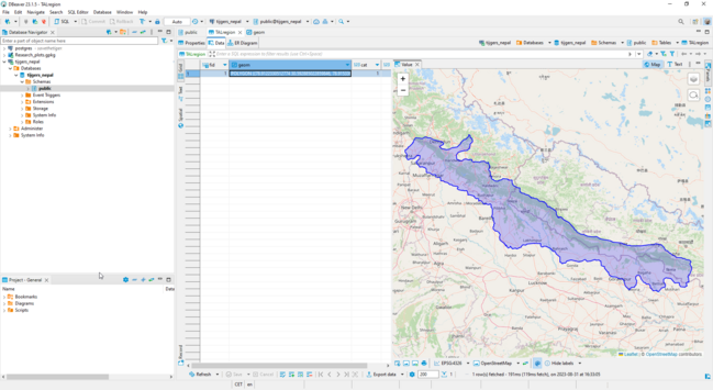
51 followers · 69 posts · Server fosstodon.orgI was looking for a database tool I could use for both #postgresql / #postgis and SQLite databases. I got the tip to look into #dbeaver. Just started using it, but I am already impressed. But of course, it is always good to know what the alternatives are. Do you have other suggestions for open source database tools that can handle different (remote and local) databases?
Paul Förster :verified_blue: · @paulfoerster
1416 followers · 6242 posts · Server swiss.social@Toasterson Found the answer: Up to, and including PostGIS 3.3.4, hdf5 has to be present before building gdal. gdal will complain if it can’t find hdf5.
Since everything on any #SUSE #Linux distribution is hopelessly out of date and I can’t choose the platform, I need to build everything. 😞 So I put building hdf5 before gdal and this seems to work without complaints from gdal.
Next: building #PostGIS 3.4.0. Let’s see what this will be like. Another nightmare on #openSUSE or #SUSE?
#suse #Linux #postgis #opensuse
Paul Förster :verified_blue: · @paulfoerster
1415 followers · 6221 posts · Server swiss.socialDoes anyone know whether the current PostGIS extension 3.3.4 for PostgreSQL still uses the hdf5 package? I’m on openSUSE Leap 15.4, compiling from source.
I ask because I can compile it from source without a) hdf5 being installed (anymore) and b) not compiling/installing hdf5 myself.
So what, if anything at all, is hdf5 being used for PostGIS? I can’t find it in the prerequisites anymore either. Can anyone help me out here, please? Do I still need it or not?
#opensuse #postgis #PostgreSQL
jerseybastion · @jerseybastion
12 followers · 8 posts · Server mapstodon.spaceThe FOSS4G team has been posting this year's talks and mine just hit the channel: https://www.youtube.com/watch?v=gl7LMEPvAmo
A companion article is here: https://www.jaxartes.net/pages/ads-b/
#FOSS4G #foss4g2023 #postgis #openskynetwork #adsb
GregCocks · @GregCocks
598 followers · 534 posts · Server techhub.socialNational Park Services (NPS) ‘Park Tiles’ [public web mapping, USA]
--
https://www.nps.gov/maps/tools/park-tiles/index.html#12/38.5640/-107.6372 <-- entry point
--
H/T @james McAndrew + @jake Coolidge
[also a mobile app ]
“Park Tiles is a suite of online basemaps designed to fit the National Park Service’s graphic identity. Built with simplicity and flexibility in mind, Park Tiles basemaps can be used as stand-alone reference maps, or customized web maps with additional data overlays. Park Tiles features NPS-sourced data inside park boundaries, and relies on OpenStreetMap data to provide additional context…”
#GIS #spatial #mapping #PostGIS #PostgresSQL #QGIS #vectortiles #opendata #opensource #gischat #ParkTiles #OSM #basemaps #NPS #maps #webmaps
@NPS
#gis #spatial #mapping #postgis #postgressql #qgis #vectortiles #opendata #opensource #gischat #parktiles #osm #basemaps #nps #Maps #webmaps
Jody Garnett · @jodygarnett
75 followers · 135 posts · Server fosstodon.orgBill · @bil
631 followers · 556 posts · Server vis.socialWhile I'm still trying to get #postgis 3.3 on my Mac and RDS instances, the team is barreling on ahead to 3.4. Amazing work, y'all.
Nicolas Fränkel · @frankel
849 followers · 1043 posts · Server mastodon.topXKCD Bad #Map Projection with #PostGIS
https://www.crunchydata.com/blog/xkcd-bad-map-projection-with-postgis
Beej · @beejjorgensen
140 followers · 279 posts · Server mastodon.sdf.orgBringing #XKCD 's absolute value map projection to life with #postgis.
https://www.crunchydata.com/blog/xkcd-bad-map-projection-with-postgis
GregCocks · @GregCocks
532 followers · 481 posts · Server techhub.socialFINALLY getting (correction: MAKING!) a chance to learn some #PostGIS and utilise it in a 'real world' setting!
I appreciate the opportunity...
#GIS #spatial #mapping #postgresql #postgres #spatialdata #opensource #gischat #selflearning #alwayslearning #opendata #appliedscience #datadelivery #database #rdbms #OGC #STGeometry
@opengeospatial
#postgis #gis #spatial #mapping #PostgreSQL #postgres #spatialdata #opensource #gischat #selflearning #alwayslearning #opendata #appliedscience #datadelivery #database #rdbms #ogc #stgeometry
Konstantin 🚀 · @konstantin
805 followers · 216 posts · Server social.headbright.euPostGIS is so cool, did you know you can just make it return rows as GeoJSON?
Say you have a table with an id, location and other columns. You can `SELECT ST_AsGeoJSON(t.*) FROM thetable AS t` and it will return niceley formatted #GeoJSON puttin all extra columns as "properties". Even the SRID of the location will be added 🤩
· @aandre
13 followers · 65 posts · Server mapstodon.space#jeRecrute (pas moi) Le CNPF recrute un·e apprenti·e géomaticien·ne
https://www.theia-land.fr/le-cnpf-recrute-une-apprentie-geomaticienne
#Géomatique #Télédétection #traitementDImage #SIG #développement #PostGIS #QGIS #Geoserver #OTB #Python #Apprentissage #Alternance
#jerecrute #geomatique #teledetection #traitementdimage #sig #developpement #postgis #qgis #geoserver #otb #python #apprentissage #alternance
stevefaeembra · @stevefaeembra
175 followers · 91 posts · Server mapstodon.spaceRevisiting an old project - pub "ley lines".🍺 Finding chance aligments in spatial features.
Here I use pubs, data copyright #openstreetmap contributors. Done in #qgis #postgis
Definition - a line, 200km or longer, with 6 or more pubs within 5m of the line. (The end points count as 2)
Because of random sampling you get different results each time.
They are way more common than you would expect by intuition. This is with a 5% sample.
James Jefferies · @jamesjefferies
245 followers · 923 posts · Server mastodon.me.ukGregCocks · @GregCocks
396 followers · 431 posts · Server techhub.socialSometimes you just need to do - well at least I need to do - #systemsdesign in the old school way...
#GIS #spatial #mapping #opendata #3DHP #research #development #water #hydrology #design #PostgreSQL #PostGIS #datadelivery #publicdata
#systemsdesign #gis #spatial #mapping #opendata #3dhp #research #development #water #hydrology #Design #PostgreSQL #postgis #datadelivery #publicdata
Rony Nedkov · @rony
21 followers · 14 posts · Server mapstodon.spacePostgis day is also very interesting! Usually in November, but I haven't seen a date yet for 2023 #postgisday #postgis
Rony Nedkov · @rony
20 followers · 9 posts · Server mapstodon.spaceInterested in the why, what and how behind my new side project https://mapstyler.com?
I wrote a blog post. https://www.oneprojectatatime.nl/launching-mapstyler/
#WebGIS #geospatial #Openlayers #gischat #postgis


