Northumbrian Stories · @northfolk
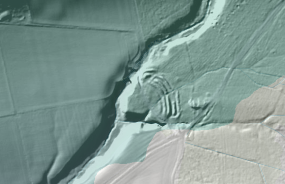
801 followers · 164 posts · Server thefolklore.cafeTo add context for anyone interested in the layout of the #Prehistoric site, here is some lidar data, which makes it much clearer than Google Maps can, as it reveals what's hidden under the tree cover. I'd scrambled through those ditches a hundred times and never realised how they formed a picture with the landscape until I saw maps showing this.
My guess would be that they post-date the #CupAndRingMarks (second pic) outside the embankments, but I'm no expert.
#Prehistory #Archaeology #RockCarvings #RingDitches #Northumberland
#prehistoric #cupandringmarks #prehistory #archaeology #rockcarvings #ringditches #northumberland
