
Daniele10 · @daniele_Hesse
146 followers · 1093 posts · Server mstdn.party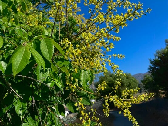
iPhone image from my daily walk in #SantaBarbara #Coastal #SantaYnezMountains#Saturday #BloomScrolling
#santabarbara #coastal #santaynezmountains #bloomscrolling

Conspiracy of Cartographers · @ConspiracyOfCartographers
210 followers · 30 posts · Server mastodon.social
Not to be outdone by the previous map to the east, this is the 1952 USGS quad of Goleta.
A different kind of flooding...with 66m of sea level rise—if all the world’s ice caps melted.
#santabarbara #montecito #ucsb #pch #the101 #goleta #santaynezmountains #vintagemaps #oldmaps #retrofuture #steampunk #solarpunk #shadedrelief #searisemaps #sealevelrise #sealevelrisemaps #climatechange #climatechangemaps #maps #cartography #speculativecartography #conspiracyofcartographers
#santabarbara #montecito #ucsb #pch #the101 #goleta #santaynezmountains #vintagemaps #oldmaps #retrofuture #steampunk #solarpunk #shadedrelief #searisemaps #sealevelrise #sealevelrisemaps #climatechange #climatechangemaps #maps #cartography #speculativecartography #conspiracyofcartographers
Conspiracy of Cartographers · @ConspiracyOfCartographers
191 followers · 29 posts · Server mastodon.social
A different kind of flooding...Santa Barbara retrofuture…this is a USGS quad from 1952, with 218’ of sea level rise—if all the world’s ice caps melted.
#santabarbara #montecito #ucsb #pch #the101 #lamesa #santaynezmountains #vintagemaps #coolmaps #oldmaps #retrofuture #steampunk #3dterrain #shadedrelief
#searise #searisemaps #sealevelrise #sealevelrisemaps #climatechange #climatechangemaps #maps #cartography #speculativecartography #speculativemaps #conspiracyofcartographers
#santabarbara #montecito #ucsb #pch #the101 #lamesa #santaynezmountains #vintagemaps #coolmaps #oldmaps #retrofuture #steampunk #3dterrain #shadedrelief #searise #searisemaps #sealevelrise #sealevelrisemaps #climatechange #climatechangemaps #maps #cartography #speculativecartography #speculativemaps #conspiracyofcartographers