· @gishubio
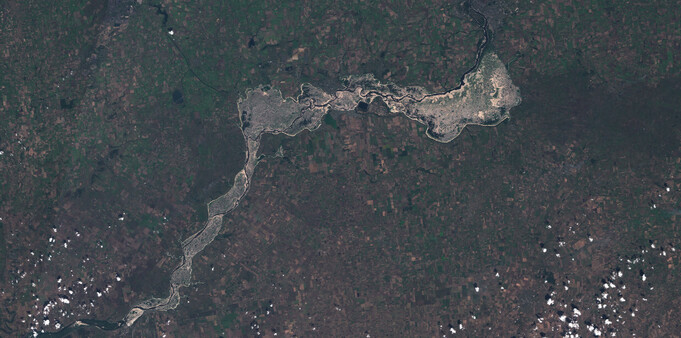
1 followers · 10 posts · Server fosstodon.orgSatellite image animation of the destruction of the Kakhovka dam, Ukraine
janggolan · @janggolan
176 followers · 7936 posts · Server mastodon.cloudOld #Soviet #satellite breaks apart in #orbit after space debris collision...
https://www.space.com/soviet-satellite-breaks-apart-after-debris-strike
The problem is that even a #space junk fragment as small as 0.4 inches can cause serious damage. In 2016, a #SpaceDebris fragment only a few millimeters wide punched a 16-inch (40 cm) wide hole into one of the solar panels of Europe's Earth-observing satellite #Sentinel2.
#soviet #satellite #orbit #space #spacedebris #sentinel2
Die_Primel · @Die_Primel
458 followers · 13940 posts · Server det.socialRetrööt Copernicus EU @CopernicusEU:
"#ImageOfTheDay
The fire in northeast #Greece🇬🇷 near Alexandroupolis is one of the largest ever recorded in Europe
It continues to ravage the Dadia National Park
15,000 people have been evacuated
⬇️#Copernicus #Sentinel2🇪🇺🛰️captured the northern front of the fires on 25 August"
#ImageOfTheDay #greece #Copernicus #sentinel2
· @milvus
183 followers · 435 posts · Server mastodon.cloudUsing the #Copernicus OpenEO API to analyze remote satellite datasets with #RStats
https://r.iresmi.net/posts/2023/copernicus_openeo_ndvi_time_series/
#copernicus #rstats #remotesensing #sentinel2
pyQGIS · @pyQGIS
45 followers · 123 posts · Server social.anoxinon.deLuca Congedo · @lucacongedo_gis
20 followers · 4 posts · Server fosstodon.orgA very basic #tutorial about "Remotior Sensus", a #Python package that allows for the processing of #remotesensing images and #GIS data.
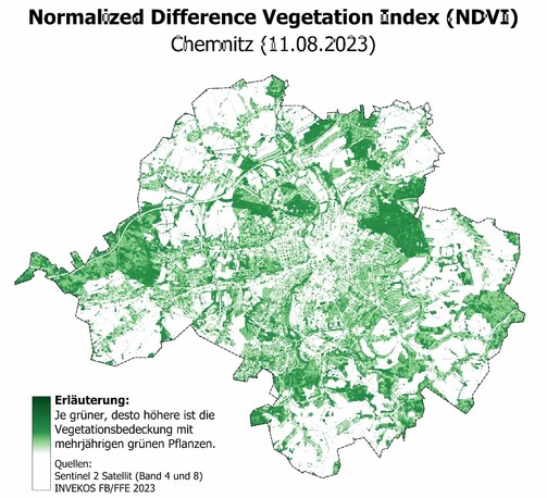
The tutorial (available in #Google Colab) describes the management of raster bands, the download of a #sentinel2 image, the calculation of NDVI
https://fromgistors.blogspot.com/2023/02/remotior-sensus-basic-tutorial.html
#tutorial #python #remotesensing #gis #google #sentinel2
Luca Congedo · @lucacongedo_gis
20 followers · 4 posts · Server fosstodon.orgThe Semi-Automatic Classification Plugin for #qgis will be released in October 2023.
This new version will improve the capabilities of Semi-Automatic Classification Plugin, based on a completely new #python processing framework that is Remotior Sensus, developed for image classification such as #landsat #sentinel2 , #machinelearning and #gis spatial analyses.
https://fromgistors.blogspot.com/2023/07/Semi-AutomaticClassificationPluginReleaseDate.html
#qgis #python #landsat #sentinel2 #machinelearning #gis
AI6YR · @ai6yr
4299 followers · 27114 posts · Server m.ai6yr.orgInteresting shortwave infrared signature off the coast of #Algeria on 7/19/2023. Curious if this is because of dust or smoke in the clouds or is some kind of imaging artifact -- shows up as red in IR. #satellite #imaging #SWIR #Sentinel2
#algeria #satellite #imaging #swir #sentinel2
AI6YR · @ai6yr
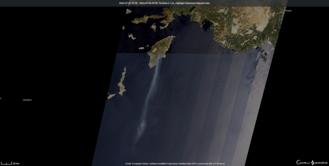
4262 followers · 26530 posts · Server m.ai6yr.org#Rhodes #Greece showing #wildfires and #smoke plume on 7/23/2023. #Sentinel2 #satellite #imaging
#rhodes #greece #wildfires #smoke #sentinel2 #satellite #imaging
Jáchym Brzezina · @jachym
139 followers · 78 posts · Server mastodonczech.cz1/4 Nejnovější snímky (23. 7. 2023) z družice #Sentinel2 ukazují rozsah požáru na ostrově Rhodos. Nejprve snímky v reálných barvách různého detailu. Kromě spálené oblasti je vidět zejména dlouhá kouřová vlečka táhnoucí se na jih.
#sentinel2 #rhodos #druzice #pozar
Jáchym Brzezina · @jachym
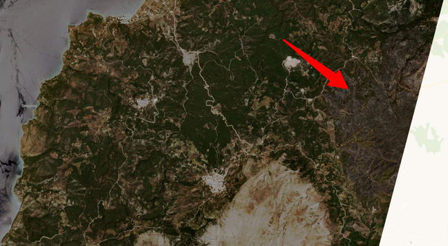
139 followers · 77 posts · Server mastodonczech.czRozsáhlé požáry na ostrově Rhodos - takto je zaznamenala evropská družice #sentinel2 od
Copernicus ECMWF. Na snímku z 21. 7. 2023 je jasně patrná spálená oblast. Oblast zasažená požáry je větší a pokračuje od snímku dále na jihovýchod.
#sentinel2 #rhodes #wildfire #greece #rhodos
BNHR.XYZ :tux: :qgis: · @bnhrdotxyz
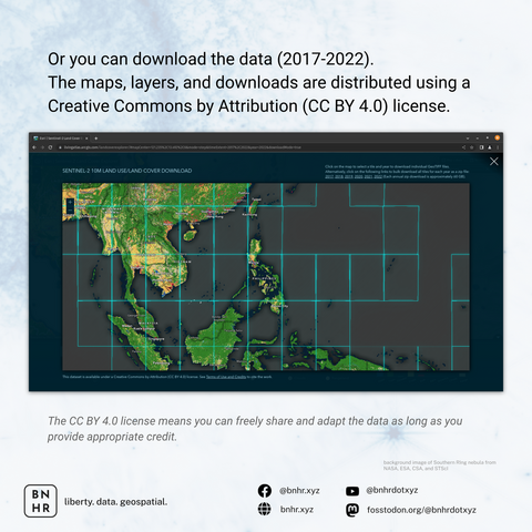
55 followers · 46 posts · Server fosstodon.orgThe maps, layers, and downloads are distributed using a Creative Commons by Attribution (CC BY 4.0) license which means you can freely share and adapt the data as long as you provide appropriate credit.
#GIS #GISChat #QGIS #Geospatial #LandCover #RemoteSensing #Sentinel2 #Data #OpenData
#gis #gischat #qgis #geospatial #landcover #remotesensing #sentinel2 #data #opendata
BNHR.XYZ :tux: :qgis: · @bnhrdotxyz
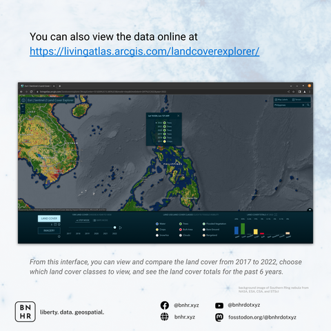
55 followers · 46 posts · Server fosstodon.orgYou can also view the data online or download it at https://livingatlas.arcgis.com/landcoverexplorer/ or learn more about the data at https://livingatlas.arcgis.com/landcover/
🧵4/
#GIS #GISChat #QGIS #Geospatial #LandCover #RemoteSensing #Sentinel2
#gis #gischat #qgis #geospatial #landcover #remotesensing #sentinel2
BNHR.XYZ :tux: :qgis: · @bnhrdotxyz
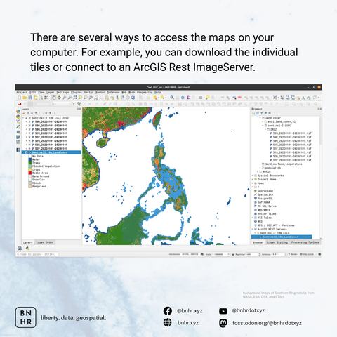
55 followers · 46 posts · Server fosstodon.orgThere are several ways to access the maps on your computer (or in #QGIS). You can download the individual tiles or connect to an #ArcGIS Rest ImageServer.
🧵3/
#qgis #arcgis #gis #gischat #geospatial #remotesensing #sentinel2
BNHR.XYZ :tux: :qgis: · @bnhrdotxyz
55 followers · 42 posts · Server fosstodon.orgLOOKING FOR UPDATED LAND COVER MAPS?
Esri, in partnership with the Impact Observatory, released their latest Land Cover Map with improved AI modeling.
IMPORTANT: The quality and fit for purpose to local applications of remotely sensed, global scale, AI products will vary. Do not accept the results/outputs blindly and always try to verify/validate to determine the accuracy/usefulness of the data for your application.
🧵 1/
#GIS #GISChat #QGIS #Geospatial #LandCover #RemoteSensing #Sentinel2
#gis #gischat #qgis #geospatial #landcover #remotesensing #sentinel2
mundialis GmbH & Co. KG · @mundialis
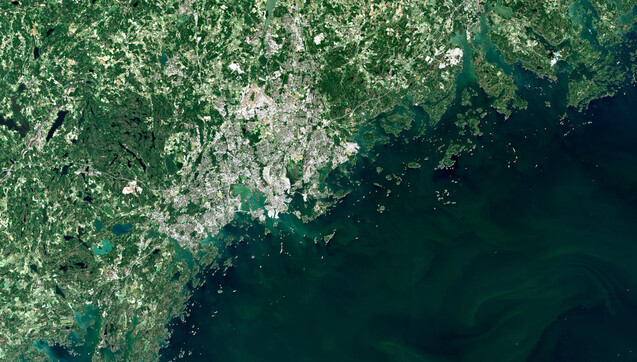
98 followers · 33 posts · Server fosstodon.orgLast week we visited #Helsinki and its many islands during the @MOOD_H2020
Scientific Conference and General Assembly. It even looks amazing from above: https://mundialis.de/en/satellitenbild-des-monats-juli-helsinki-finnland/ made with #OSGeo
#Sentinel2 #Copernicus #satelliteimageofthemonth #Finland #datascience #onehealth
#helsinki #osgeo #sentinel2 #copernicus #satelliteimageofthemonth #finland #datascience #onehealth
AI6YR · @ai6yr
3865 followers · 23080 posts · Server m.ai6yr.orgFrom EU_Commission Directorate-General for Defence Industry and Space: A heatwave♨️has swept across the eastern Atlantic Ocean, the Iberian Peninsula & North Africa
On 27 June, in #Funchal (#Madeira🇵🇹), the air T° soared to 38.7°C, setting a new record for the highest temperature of the🏙️
⬇️#Sentinel2 image acquired on the same day #heatwave #Spain #Iberia
#funchal #Madeira #sentinel2 #heatwave #spain #iberia
mundialis GmbH & Co. KG · @mundialis
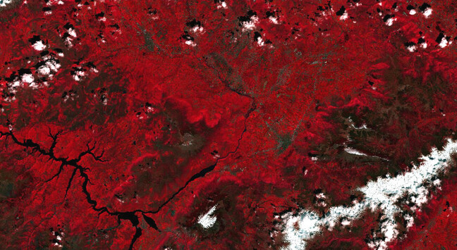
97 followers · 31 posts · Server fosstodon.orgThe annual FOSS4G takes place in #Prizren, Kosovo, this year (26/06 – 02/07)! Have a look at the surroundings of the city on our satellite image of the month June: https://www.mundialis.de/en/satellitenbild-des-monats-juni-prizren-republik-kosovo/ made with #OSGeo
#Sentinel2 #Copernicus #satelliteimageofthemonth #FOSS4G #Prizren #Kosovo
#prizren #osgeo #sentinel2 #copernicus #satelliteimageofthemonth #foss4g #kosovo
Niels Anders · @nanders
0 followers · 1 posts · Server datasci.socialNew at datasci.social! A short intro: I analyze the #sustainability of the supply chains of mainly food processing companies, especially related to #deforestation and #scope3 #CO2 #emission around various #commodities such as #oilpalm #soy #coffee and #cocoa. With others I model #aboveground #biomass using EO data #landat #sentinel-1 #sentinel2 #gedi and combine it with historic and near-realtime #deforestation #detections
#sustainability #deforestation #scope3 #co2 #emission #commodities #oilpalm #soy #coffee #cocoa #aboveground #biomass #landat #sentinel #sentinel2 #gedi #detections
Dr. Tatiana Ilyina 🌍🌊 O=C=O 💙💛 · @TatianaIlyina
1864 followers · 1462 posts · Server mas.toRT @i_ameztoy
#Lützerath vs open-pit coal mines, between dreams & utopia in the era of #climatecrisis. This was probably a symbol or will be remembered as such. Now it is gone. More will come. #Copernicus #Sentinel2 🛰️ 2022 - 2023
#sentinel2 #copernicus #climatecrisis #Lutzerath
