
RustyLMehlberg · @RustyMehlberg
110 followers · 620 posts · Server newsie.social
8 P.M. #RADAR UPDATE:
A line of #showers with a few #thunderstorms and heavy #rain are moving through the heart of the #Northland late this evening.
Again, nothing is #severe. The threat of showers will continue through the night and Tuesday morning.
#radar #showers #thunderstorms #rain #northland #severe #wx #wxtooter #weather #mnwx #wiwx #upwx
RustyLMehlberg · @RustyMehlberg
109 followers · 603 posts · Server newsie.social
Happy #Wednesday from the #Northland!
Tuesday's #severe #weather event did not disappoint. While the high #winds and large #hail was somewhat limited in coverage, everyone saw the heavy #rain Rainfall totals ranged from near 1" to to just under 4".
Cooler weather has arrived with some lingering #sprinkles and #mist. #Fall is here!
#wednesday #northland #severe #weather #winds #hail #rain #sprinkles #mist #fall #wxtooter #wx #mnwx #wiwx #upwx
RustyLMehlberg · @RustyMehlberg
109 followers · 580 posts · Server newsie.social
(Getting in-between #severe #weather events for my daily posts...)
NORTHLAND FORECAST FOR SPETEMBER 6, 2023:
#Showers and #thunderstorms, some of which will contain high #winds, large #hail, and heavy #rain, will pass through the #Northland Tuesday night.
As #showers become scattered and move out of the region Wednesday, #winds will become #breezy with #temperatures staying in the #fall-like level.
VIDEO: https://www.fox21online.com/2023/09/05/tuesday-evening-northland-forecast-9-5-2023/
#severe #weather #showers #thunderstorms #winds #hail #rain #northland #breezy #temperatures #fall #wxtooter #wx #forecast #mnwx #wiwx #upwx
RustyLMehlberg · @RustyMehlberg
109 followers · 578 posts · Server newsie.social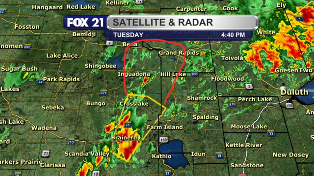
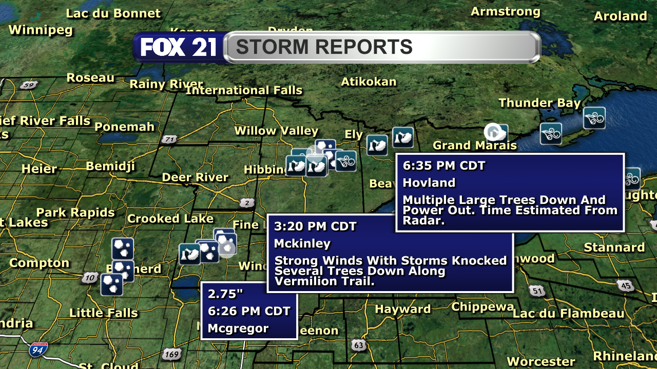
A heads up for people in northwest #Aitkin and #Itasca counties.
A #severe #thunderstorm in the Brainerd area will be heading your way.
We will have to wait and see if it remains severe over the next few hours. If it does, expect high #winds and large #hail.
#aitkin #itasca #severe #thunderstorm #winds #hail #wxtooter #wx #weather #mnwx
RustyLMehlberg · @RustyMehlberg
109 followers · 575 posts · Server newsie.social
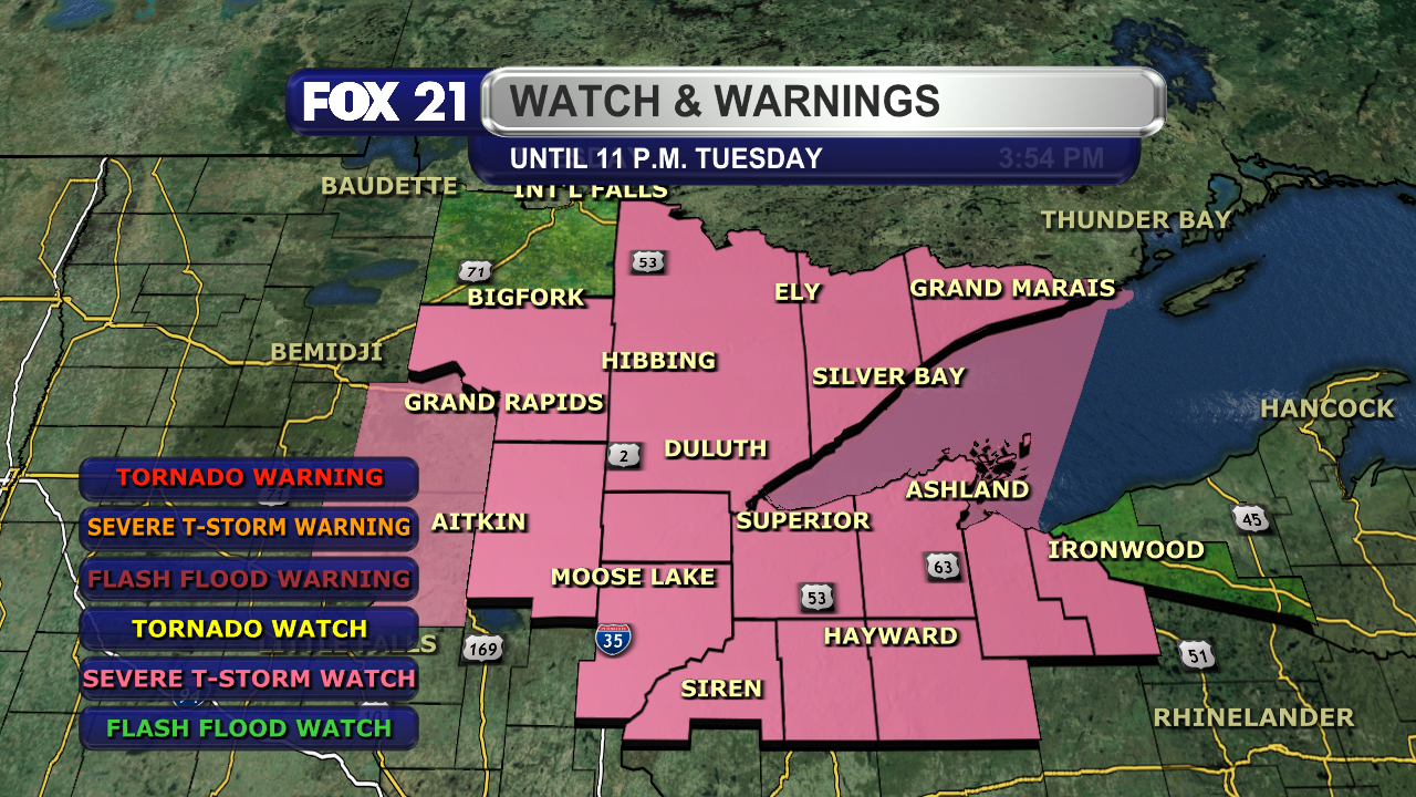
The threat for severe #weather has picked up with a watch until 11 p.m. for most of the #Northland.
We will be monitoring the current #storms passing through the #Arrowhead for additional strengthening, with more developing to the south and east likely to get underway soon.
Greatest threats are for high #winds, large #hail, and a possible weak spin-up #tornado.
#severe #thunderstorm #watch #weather #northland #storms #arrowhead #winds #hail #tornado #wxtooter #wx #mnwx #wiwx #upwx
RustyLMehlberg · @RustyMehlberg
109 followers · 572 posts · Server newsie.social
Happy #Tuesday from the #Northland!
The early #fall #heat #wave will be ending today, so if you enjoy the #summer-like #heat and #humidity...soak it in!
However, the nation's #severe #weather threat is in our corner of the country.
Be alert the rest of today as some storms could contain high #winds, large #hail, heavy #rain, and maybe a weak #tornado.
#tuesday #northland #fall #heat #wave #summer #humidity #severe #weather #winds #hail #rain #tornado #wx #wxtooter #mnwx #wiwx #upwx
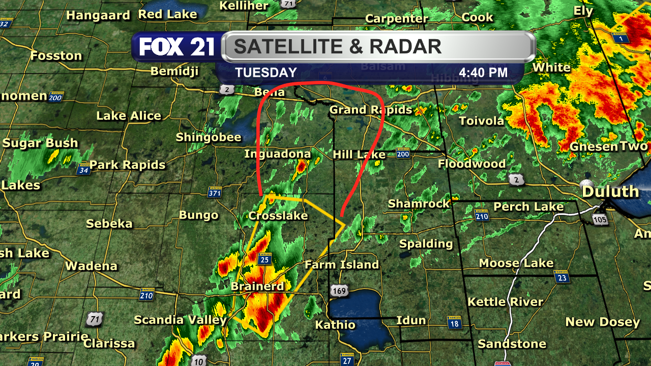
RustyLMehlberg · @RustyMehlberg
109 followers · 570 posts · Server newsie.socialNORTHLAND FORECAST FOR SPETEMBER 5, 2023:
The #heat #wave continues in the #Northland Monday night with mostly clear #skies, light #winds, and lows in the upper 60s and low 70s.
Tuesday will see most #temperatures reach the 80s and low 90s. #Clouds will be increasing as a #storm #system brings #showers and #thunderstorms, some #strong and #severe, by the afternoon and evening.
VIDEO: https://www.fox21online.com/2023/09/04/monday-evening-northland-forecast-9-4-2023/
#heat #wave #northland #skies #winds #temperatures #clouds #storm #system #showers #thunderstorms #strong #severe #wxtooter #wx #weather #forecast #mnwx #wiwx #upwx
RustyLMehlberg · @RustyMehlberg
109 followers · 545 posts · Server newsie.social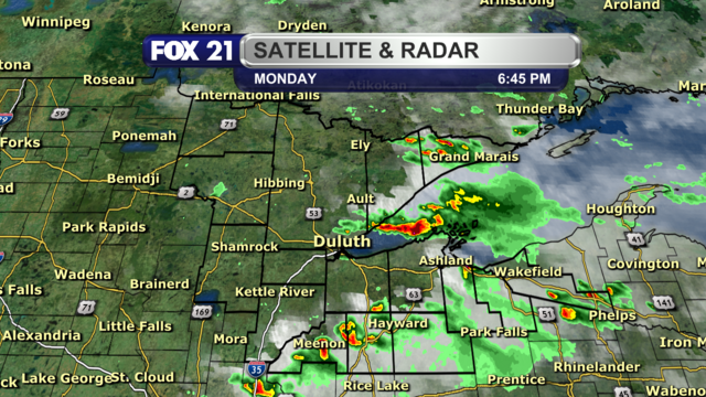
6:45 P.M. #RADAR UPDATE:
#Showers and #thunderstorms continue to move through the #Northland this evening.
The strongest will come across the #Bayfield Peninsula over the next hour. It is not #severe, but expect small #hail and #winds up to 30 mph.
#wiwx #upwx #radar #showers #thunderstorms #northland #bayfield #severe #hail #winds #wxtooter #weather #wx #mnwx
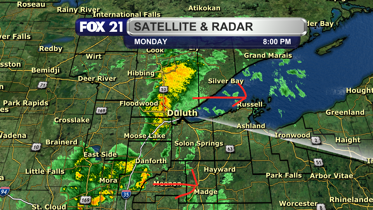
RustyLMehlberg · @RustyMehlberg
109 followers · 539 posts · Server newsie.social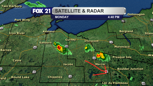
4:40 P.M. #RADAR UPDATE:
Pockets of #showers and #thunderstorms continue to move through the #Northland, generally from northwest to southeast.
Nothing is #severe, but expect a brief #downpour, #lightning, a gust of #wind, and very small #hail.
#radar #showers #thunderstorms #northland #severe #downpour #lightning #wind #hail #wxtooter #weather #mnwx #wiwx #upwx
RustyLMehlberg · @RustyMehlberg
107 followers · 505 posts · Server newsie.social
As the #severe #weather threat moves out of the #Northland, Thursday's weather headline will be the return of #wildfire #smoke to the region from Canada.
An #Air #Quality #Alert now covers the #Wisconsin portion of the Northland for Thursday and Friday.
Air quality levels will deteriorate enough to become unhealthy for everyone at times.
#wxtooter #MNwx #WIwx
#severe #weather #northland #wildfire #smoke #air #quality #alert #wisconsin #wxtooter #mnwx #wiwx
RustyLMehlberg · @RustyMehlberg
107 followers · 504 posts · Server newsie.social
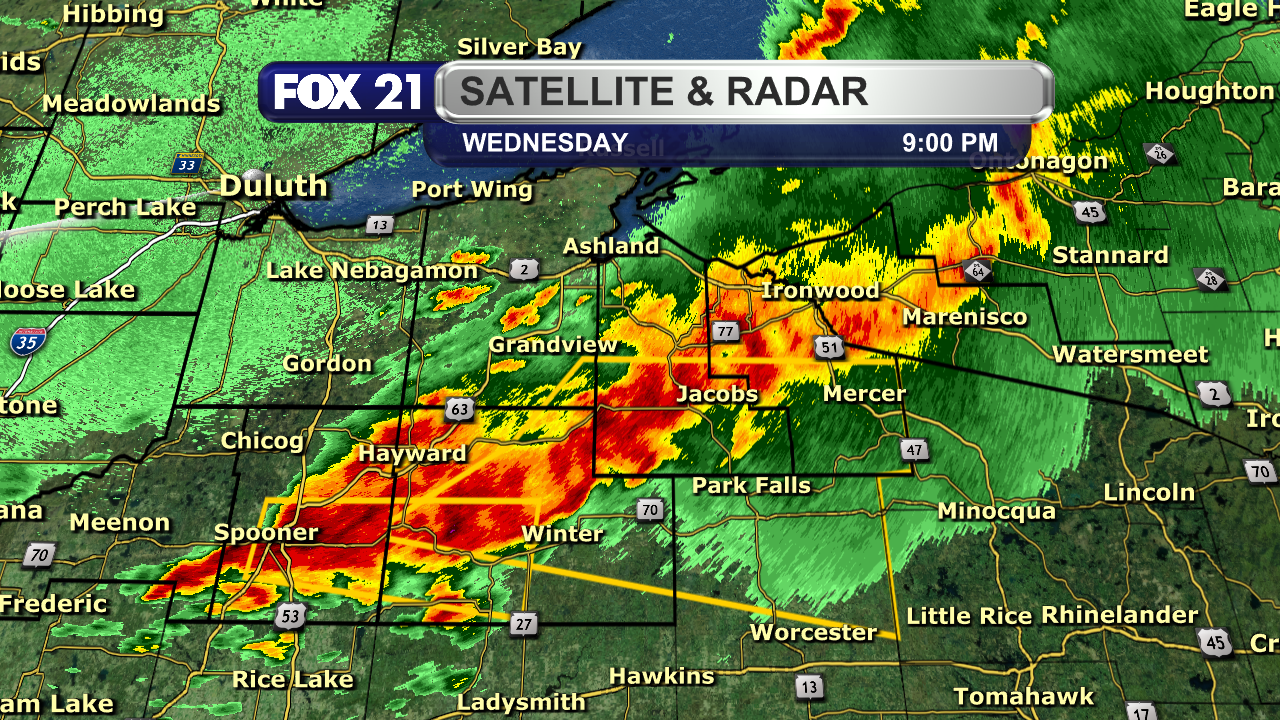
9 P.M. #RADAR AND #SEVERE #WEATHER UPDATE:
The line of #thunderstorms moving through the #Northland, specifically northwest Wisconsin and the Upper Peninsula, continues to have segments strong enough for Severe Thunderstorm #Warnings.
The greatest concern is for #winds up to 60 mph and #hail up to 1.25" in diameter.
#radar #severe #weather #thunderstorms #northland #warnings #winds #hail #wxtooter #wiwx #upwx
RustyLMehlberg · @RustyMehlberg
106 followers · 496 posts · Server newsie.social
#SEVERE #THUNDERSTORM #WARNING:
The thunderstorm that went through the #TwinPorts have the potential for #winds up to 60 mph along the #SouthShore.
People on and around Highways 13 and 2 need to take shelter now. This warning last until 7 p.m.
#severe #thunderstorm #warning #twinports #winds #southshore #wxtooter #weather #wiwx
RustyLMehlberg · @RustyMehlberg
106 followers · 496 posts · Server newsie.social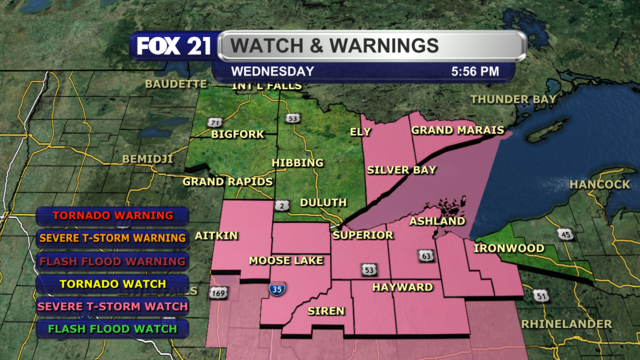
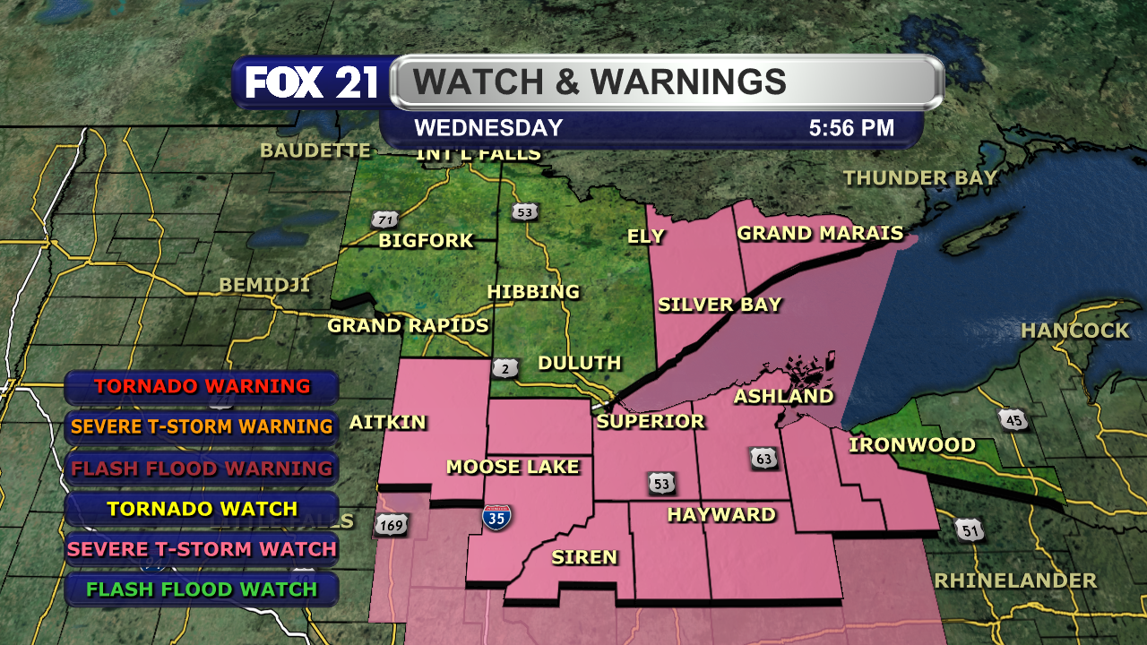
It has finally been issued. A Severe Thunderstorm Watch is in effect until midnight for the #Arrowhead, northwest #Wisconsin, and the I-35 corridor.
The worst of the storms could have #winds up to 70 mph and #hail up to 1.5" in diameter.
#severe #thunderstorm #watch #arrowhead #wisconsin #winds #hail #wxtooter #weather #mnwx #wiwx #upwx
RustyLMehlberg · @RustyMehlberg
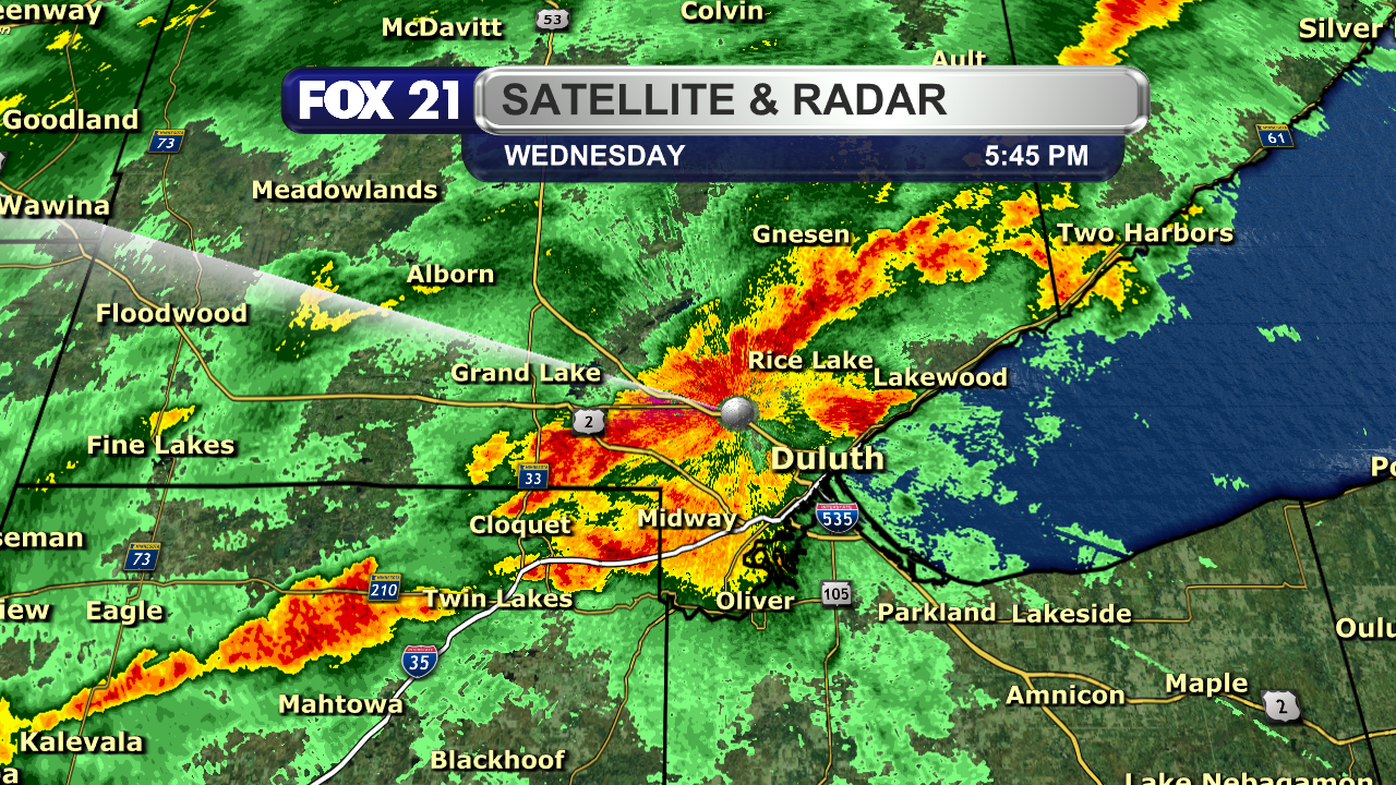
106 followers · 496 posts · Server newsie.social
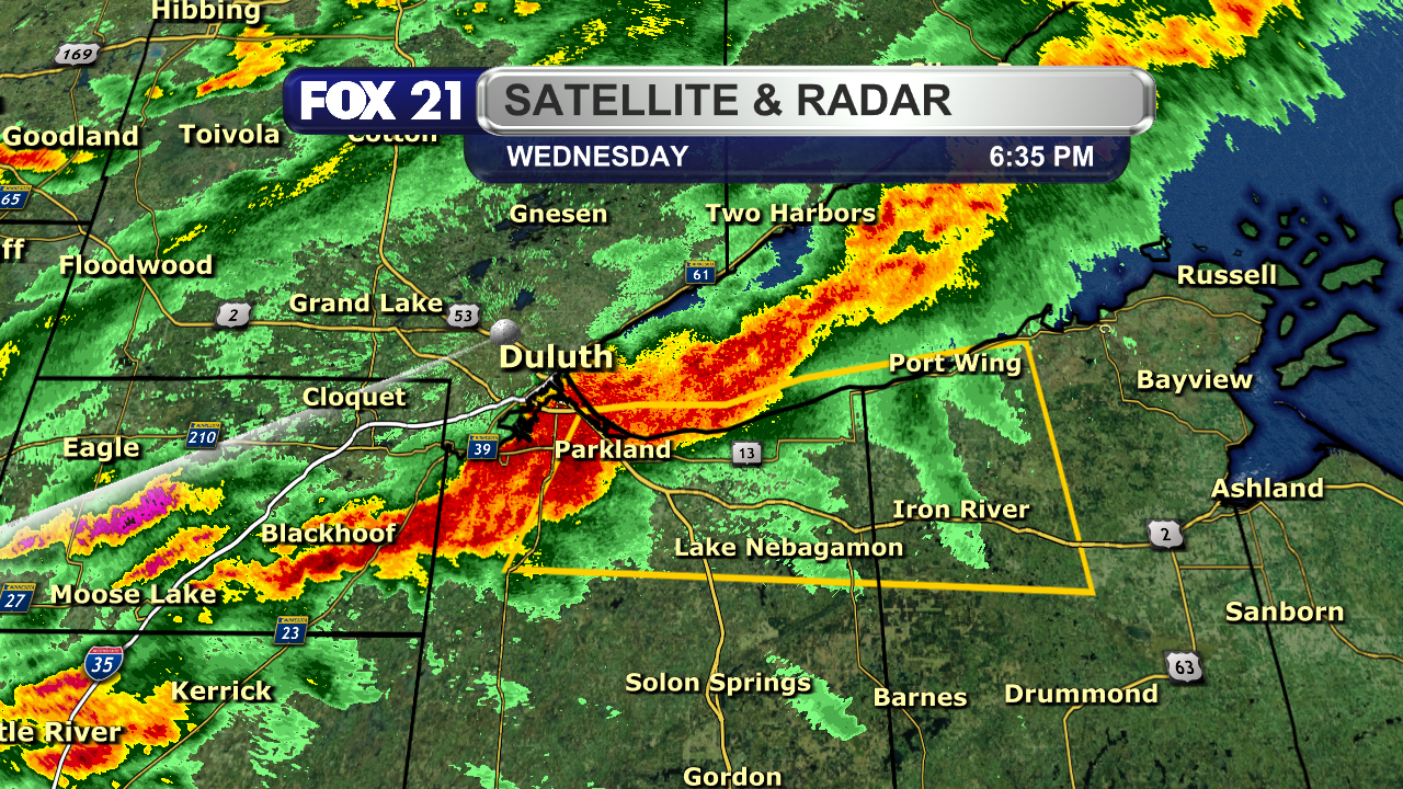
5:45 P.M. RADAR UPDATE:
Get ready #TwinPorts! This cluster of #showers and #thunderstorms will bring a decent downpour over the next hour.
Good news is that this is not #severe, but expect gusty #winds and small #hail.
#twinports #showers #thunderstorms #severe #winds #hail #wxtooter #weather #mnwx #wiwx
RustyLMehlberg · @RustyMehlberg
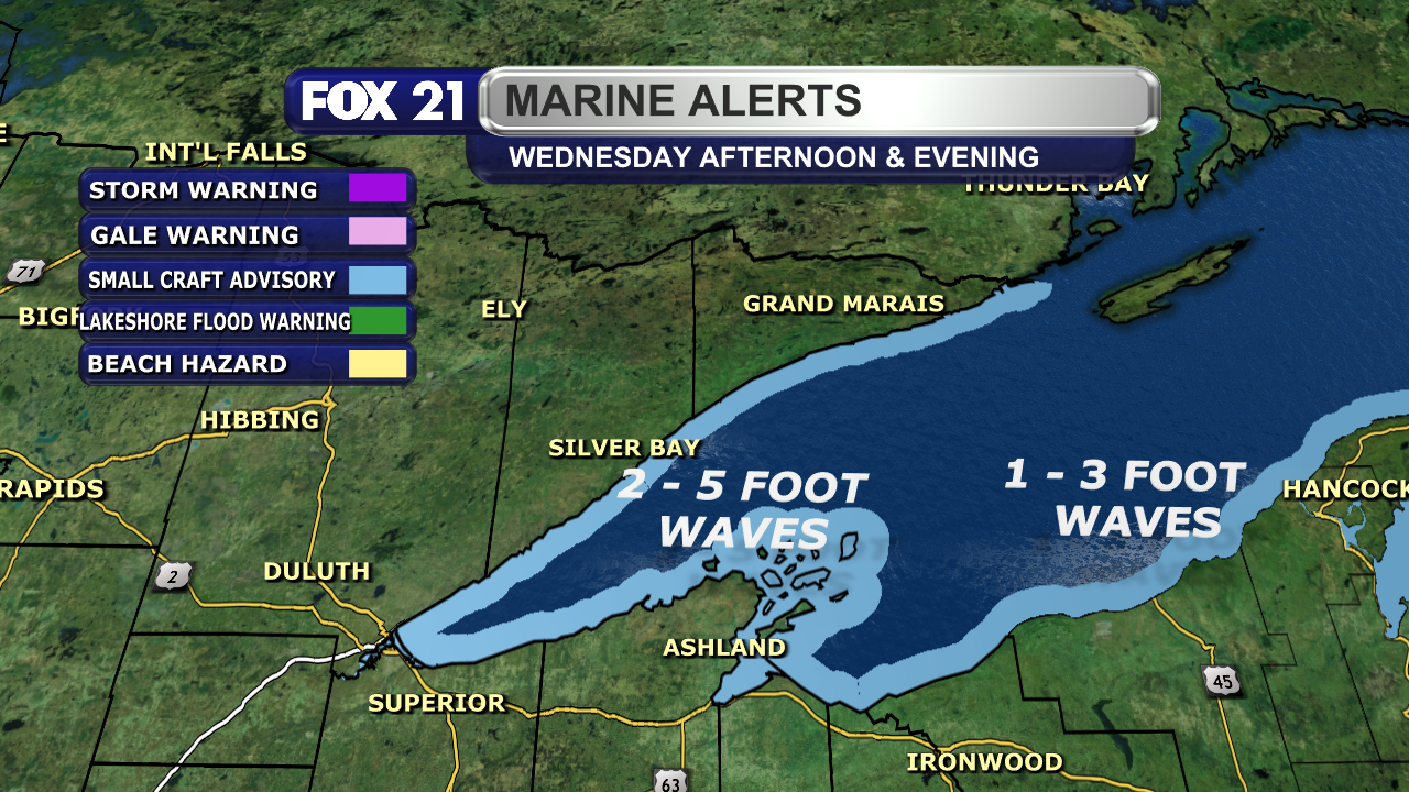
106 followers · 488 posts · Server newsie.social
In addition to the possible #strong and #severe #thunderstorms in the #Northland Wednesday, #gusty southwest #winds will make the waters on #Lake #Superior choppy.
#Small #Craft #Advisory will be in effect during the afternoon and evening hours along the shoreline.
#strong #severe #thunderstorms #northland #gusty #winds #lake #superior #small #craft #advisory #wxtooter #weather #mnwx #wiwx #upwx
RustyLMehlberg · @RustyMehlberg
102 followers · 473 posts · Server newsie.social5:30 UPDATE:
The line of #strong #thunderstorms in northwest #Wisconsin, formerly #severe, is moving out of the region.
Meanwhile, more widely scattered storms, some strong, are forming in the #IronRange and #Rainy #River Basin. They will continue to pass through this evening, but should not become severe.
#mnwx #wiwx #upwx #strong #thunderstorms #wisconsin #severe #ironrange #rainy #river #wxtooter #weather
RustyLMehlberg · @RustyMehlberg
102 followers · 473 posts · Server newsie.socialSEVERE THUNDERSTORM WARNING:
A new #Severe #Thunderstorm #Warning is in effect for southern #Burnett and southwest #Washburn counties until 4:45 p.m.
#Winds could gust up to 60 mph, and any #hail could be up to 1" in diameter.
Greatest threat remains for spots south of Highway 70.
#severe #thunderstorm #warning #burnett #washburn #winds #hail #wxtooter #weather #wiwx
RustyLMehlberg · @RustyMehlberg
102 followers · 471 posts · Server newsie.socialNothing like having to come in on your day off due to #severe #weather.
A severe #thunderstorms with #winds up to 80 mph is passing through southern #Pine County and southern #Burnett County through 4:30 p.m.
Anyone south of Highway 70 should seek a safe place.
Meanwhile, a severe thunderstorm #watch remains in effect for Pine, Burnett, #Washburn, and #Sawyer counties until 10 p.m. for possible #hail and high winds.
#severe #weather #thunderstorms #winds #pine #burnett #watch #washburn #sawyer #hail #wxtooter #mnwx #wiwx
RustyLMehlberg · @RustyMehlberg
102 followers · 468 posts · Server newsie.socialNORTHLAND FORECAST FOR AUGUST 11, 2023:
A wet and cool #weather pattern is ready to settle into the #Northland.
Widespread #showers and #thunderstorms will pass through Thursday night and Friday morning. A second round will follow it late Friday afternoon and evening, which could contain strong or #severe #storms.
#Winds will be breezy at times with #temperatures remaining seasonally cool.
VIDEO & DISCUSSION: https://www.fox21online.com/weather/
#weather #northland #showers #thunderstorms #severe #storms #winds #temperatures #wxtooter #forecast #mnwx #wiwx #upwx

getmisch · @GetMisch
59 followers · 764 posts · Server masto.nyc
Early- and mid-pandemic, prior COVID infections gave a mild protective effect. This waned post-Omicron, and prior infections now tend toward more severe (second) infections, or a loss of protection altogether. ANOTHER STUDY SHOWS: AVOID MULTIPLE COVID INFECTIONS
#CovidIsNotOver #MaskUp #StaySafe #masking #saves #lives #prior #infections #increase #risk of #severe #cases #organ #damage #longCOVID is #real too... https://www.medrxiv.org/content/10.1101/2023.08.03.23293612v1
#CovidIsNotOver #MaskUp #staysafe #masking #saves #lives #prior #infections #increase #risk #severe #cases #organ #damage #LongCovid #real