Follow GOLF · @fogolf
9 followers · 1417 posts · Server vive.imWatch Whitehall girls golfers discuss 2023 fall season during media day https://www.fogolf.com/579911/watch-whitehall-girls-golfers-discuss-2023-fall-season-during-media-day/
#CatchMark #Catchmarksportsnet #catchmarktechnologies #DAY #discuss #Fall #girls #Golf #golfgirlvideos #golfgirlvlog #golfgirlYouTube #Golfgirls #GOLFERS #Hart #hesperia #holton #Ludington #media #michigan #montague #Muskegon #northmuskegon #Ravenna #Season #Shelby #Sportsnet #WATCH #westmichiganconference #whitelakearea #whitelakesports #Whitehall
#catchmark #catchmarksportsnet #catchmarktechnologies #day #discuss #fall #girls #golf #golfgirlvideos #golfgirlvlog #golfgirlyoutube #golfgirls #golfers #hart #hesperia #holton #ludington #media #michigan #montague #muskegon #northmuskegon #ravenna #season #shelby #sportsnet #watch #westmichiganconference #whitelakearea #whitelakesports #whitehall
Chinchillidon · @Chinchillidon
109 followers · 547 posts · Server sfba.social#shelby #cobra #santaclara #santaclaraconventioncenter #siliconvalleyautoshow #funko #funkopop #sanfrancisco #sanfranciscobay #sfba #sfbayarea #esseff #thecity #bayarea
#shelby #Cobra #santaclara #santaclaraconventioncenter #siliconvalleyautoshow #Funko #FunkoPop #sanfrancisco #sanfranciscobay #sfba #sfbayarea #esseff #thecity #bayarea
EAS Watcher · @easwatch
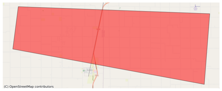
316 followers · 8777 posts · Server m.ai6yr.org#EAS for Christian, #IL; #Shelby, #IL: National Weather Service: #TORNADO WARNING in this area until 7:30 PM CDT. Take shelter now in a basement or an interior room on the lowest floor of a sturdy building. If you are outdoors, in a mobile home, or in a vehicle, move to the closest substantial shelter and protect yourself from flying debris. Check media. Source: NWS Lincoln IL** DO NOT RELY ON THIS FEED FOR LIFE SAFETY, SEEK OUT OFFICIAL SOURCES ***
EAS Watcher · @easwatch
316 followers · 8777 posts · Server m.ai6yr.org#EAS for Christian, ##IL; ##Shelby, ##IL: National Weather Service: #TORNADO WARNING in this area until 7:30 PM CDT. Take shelter now in a basement or an interior room on the lowest floor of a sturdy building. If you are outdoors, in a mobile home, or in a vehicle, move to the closest substantial shelter and protect yourself from flying debris. Check media. Source: NWS Lincoln IL** DO NOT RELY ON THIS FEED FOR LIFE SAFETY, SEEK OUT OFFICIAL SOURCES ***
EAS Watcher · @easwatch
316 followers · 8777 posts · Server m.ai6yr.orgEAS Watcher · @easwatch
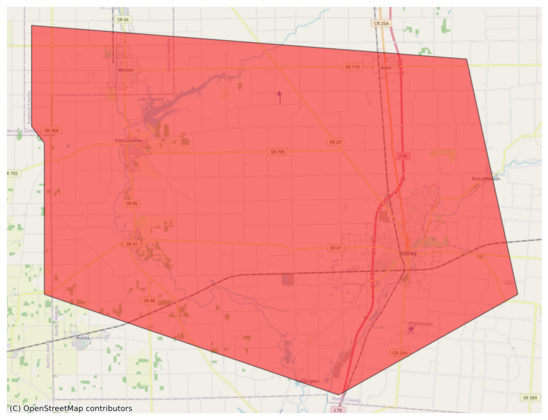
316 followers · 8128 posts · Server m.ai6yr.org#EAS for Auglaize, #OH; #Shelby, #OH: National Weather Service: #TORNADO WARNING in this area until 4:30 AM EDT. Take shelter now in a basement or an interior room on the lowest floor of a sturdy building. If you are outdoors, in a mobile home, or in a vehicle, move to the closest substantial shelter and protect yourself from flying debris. Check media. Source: NWS Wilmington OH** DO NOT RELY ON THIS FEED FOR LIFE SAFETY, SEEK OUT OFFICIAL SOURCES ***
BakersRelay · @BakerRL75
779 followers · 31751 posts · Server m.ai6yr.org#EAS for Craighead, #AR; #Crittenden, #AR; #Mississippi, #AR; #Poinsett, #AR; #DeSoto, #MS; #Marshall, #MS; #Tunica, #MS; #Fayette, #TN; #Lauderdale, #TN; #Shelby, #TN; #Tipton, #TN: National Weather Service: SEVERE THUNDERSTORM WARNING in effect for this area until 2:15 PM CDT for DESTRUCTIVE 80 mph winds. Take shelter in a sturdy building, away from windows. Flying debris may be deadly to those caught without shelter. Source: NWS Memphis TN**
#arwx #mswx #tnwx #EAS #ar #crittenden #mississippi #poinsett #desoto #ms #marshall #tunica #fayette #tn #lauderdale #shelby #tipton
EAS Watcher · @easwatch
308 followers · 8023 posts · Server m.ai6yr.org#EAS for Craighead, #AR; #Crittenden, #AR; #Mississippi, #AR; #Poinsett, #AR; #DeSoto, #MS; #Marshall, #MS; #Tunica, #MS; #Fayette, #TN; #Lauderdale, #TN; #Shelby, #TN; #Tipton, #TN: National Weather Service: SEVERE THUNDERSTORM WARNING in effect for this area until 2:15 PM CDT for DESTRUCTIVE 80 mph winds. Take shelter in a sturdy building, away from windows. Flying debris may be deadly to those caught without shelter. Source: NWS Memphis TN** DO NOT RELY ON THIS FEED FOR LIFE SAFETY, SEEK OUT
#EAS #ar #crittenden #mississippi #poinsett #desoto #ms #marshall #tunica #fayette #tn #lauderdale #shelby #tipton
Bluenose :birmingham: · @Bluenose
33 followers · 155 posts · Server thefooty.clubWow. Stunning development in that Hope Powell, CBE has been appointed the Women’s Technical Director at Birmingham. Bold move as #Wagner keeps his promises #bcfc #bcfcw #bcfcwomen #shelby
#wagner #bcfc #bcfcw #bcfcwomen #shelby
EAS Watcher · @easwatch
283 followers · 7691 posts · Server m.ai6yr.org#EAS for Harrison, #IA; #Pottawattamie, #IA; #Shelby, #IA: National Weather Service: SEVERE THUNDERSTORM WARNING in effect for this area until 7:00 AM CDT for DESTRUCTIVE 80 mph winds. Take shelter in a sturdy building, away from windows. Flying debris may be deadly to those caught without shelter. Source: NWS Omaha/Valley NE** DO NOT RELY ON THIS FEED FOR LIFE SAFETY, SEEK OUT OFFICIAL SOURCES ***
#EAS #ia #pottawattamie #shelby
EAS Watcher · @easwatch
283 followers · 7691 posts · Server m.ai6yr.org#EAS for Harrison, #IA; #Pottawattamie, #IA; #Shelby, #IA: Severe Thunderstorm Warning issued July 12 at 6:15AM CDT until July 12 at 7:00AM CDT by NWS Omaha/Valley NE Source: NWS Omaha/Valley NE** DO NOT RELY ON THIS FEED FOR LIFE SAFETY, SEEK OUT OFFICIAL SOURCES ***
#EAS #ia #pottawattamie #shelby
EAS Watcher · @easwatch
283 followers · 7685 posts · Server m.ai6yr.org#EAS for Harrison, #IA; #Pottawattamie, #IA; #Shelby, #IA; #Burt, #NE; #Dodge, #NE; #Washington, #NE: National Weather Service: SEVERE THUNDERSTORM WARNING in effect for this area until 6:30 AM CDT for DESTRUCTIVE 80 mph winds. Take shelter in a sturdy building, away from windows. Flying debris may be deadly to those caught without shelter. Source: NWS Omaha/Valley NE** DO NOT RELY ON THIS FEED FOR LIFE SAFETY, SEEK OUT OFFICIAL SOURCES ***
#EAS #ia #pottawattamie #shelby #burt #ne #dodge #washington
EAS Watcher · @easwatch
283 followers · 7684 posts · Server m.ai6yr.org#EAS for Harrison, #IA; #Pottawattamie, #IA; #Shelby, #IA; #Burt, #NE; #Dodge, #NE; #Washington, #NE: Severe Thunderstorm Warning issued July 12 at 5:50AM CDT until July 12 at 6:30AM CDT by NWS Omaha/Valley NE Source: NWS Omaha/Valley NE** DO NOT RELY ON THIS FEED FOR LIFE SAFETY, SEEK OUT OFFICIAL SOURCES ***
#EAS #ia #pottawattamie #shelby #burt #ne #dodge #washington
BakersRelay · @BakerRL75
710 followers · 26089 posts · Server m.ai6yr.org#EAS for Champaign, #IL; #Christian, #IL; #Clark, #IL; #Coles, #IL; #Cumberland, #IL; #De Witt, #IL; #Douglas, #IL; #Edgar, #IL; #Effingham, #IL; #Jasper, #IL; #McLean, #IL; #Macon, #IL; #Moultrie, #IL; #Piatt, #IL; #Shelby, #IL; #Vermilion, #IL: NWS: SEVERE THUNDERSTORM WARNING in effect for this area until 1:30 PM CDT for DESTRUCTIVE 80 mph winds. Take shelter in a sturdy building, away from windows. Flying debris may be deadly to those caught without shelter. Source: NWS
#ilwx #EAS #il #christian #clark #coles #cumberland #de #douglas #edgar #effingham #jasper #mclean #macon #moultrie #piatt #shelby #vermilion
BakersRelay · @BakerRL75
710 followers · 26089 posts · Server m.ai6yr.org#EAS for Christian, #IL; #Shelby, #IL: National Weather Service: #TORNADO WARNING in this area until 1:15 PM CDT. Take shelter now in a basement or an interior room on the lowest floor of a sturdy building. If you are outdoors, in a mobile home, or in a vehicle, move to the closest substantial shelter and protect yourself from flying debris. Check media. Source: NWS Lincoln IL** DO NOT RELY ON THIS FEED FOR LIFE SAFETY, SEEK OUT OFFICIAL SOURCES ***
#ilwx #EAS #il #shelby #tornado
EAS Watcher · @easwatch
246 followers · 7122 posts · Server m.ai6yr.org#EAS for Champaign, #IL; #Christian, #IL; #Clark, #IL; #Coles, #IL; #Cumberland, #IL; #De Witt, #IL; #Douglas, #IL; #Edgar, #IL; #Effingham, #IL; #Jasper, #IL; #McLean, #IL; #Macon, #IL; #Moultrie, #IL; #Piatt, #IL; #Shelby, #IL; #Vermilion, #IL: National Weather Service: SEVERE THUNDERSTORM WARNING in effect for this area until 1:30 PM CDT for DESTRUCTIVE 80 mph winds. Take shelter in a sturdy building, away from windows. Flying debris may be deadly to those caught without shelter. Source: NWS
#EAS #il #christian #clark #coles #cumberland #de #douglas #edgar #effingham #jasper #mclean #macon #moultrie #piatt #shelby #vermilion
EAS Watcher · @easwatch
246 followers · 7122 posts · Server m.ai6yr.org#EAS for Champaign, #IL; #Christian, #IL; #Clark, #IL; #Coles, #IL; #Cumberland, #IL; #De Witt, #IL; #Douglas, #IL; #Edgar, #IL; #Effingham, #IL; #Jasper, #IL; #McLean, #IL; #Macon, #IL; #Moultrie, #IL; #Piatt, #IL; #Shelby, #IL; #Vermilion, #IL: Severe Thunderstorm Warning issued June 29 at 12:51PM CDT until June 29 at 1:30PM CDT by NWS Lincoln IL Source: NWS Lincoln IL** DO NOT RELY ON THIS FEED FOR LIFE SAFETY, SEEK OUT OFFICIAL SOURCES ***
#EAS #il #christian #clark #coles #cumberland #de #douglas #edgar #effingham #jasper #mclean #macon #moultrie #piatt #shelby #vermilion
EAS Watcher · @easwatch
246 followers · 7120 posts · Server m.ai6yr.org#EAS for Christian, #IL; #Shelby, #IL: National Weather Service: #TORNADO WARNING in this area until 1:15 PM CDT. Take shelter now in a basement or an interior room on the lowest floor of a sturdy building. If you are outdoors, in a mobile home, or in a vehicle, move to the closest substantial shelter and protect yourself from flying debris. Check media. Source: NWS Lincoln IL** DO NOT RELY ON THIS FEED FOR LIFE SAFETY, SEEK OUT OFFICIAL SOURCES ***
EAS Watcher · @easwatch
246 followers · 7119 posts · Server m.ai6yr.orgEAS Watcher · @easwatch
244 followers · 6882 posts · Server m.ai6yr.org#EAS for Johnson, #IN; #Marion, #IN; #Rush, #IN; #Shelby, #IN: National Weather Service: #TORNADO WARNING in this area until 5:00 PM EDT. Take shelter now in a basement or an interior room on the lowest floor of a sturdy building. If you are outdoors, in a mobile home, or in a vehicle, move to the closest substantial shelter and protect yourself from flying debris. Check media. Source: NWS Indianapolis IN** DO NOT RELY ON THIS FEED FOR LIFE SAFETY, SEEK OUT OFFICIAL SOURCES ***
#EAS #in #marion #rush #shelby #tornado


