
Postholer · @postholer
18 followers · 59 posts · Server mapstodon.space
No enterprise #GIS spatial database? No problem.
Create the leanest, ad hoc virtual vector database(s) with robust spatial functions using core software @GdalOrg
& #Spatialite (and you probably have them installed).
How-To: https://postholer.com/portfolio/index.php?example=vrtdb

stevefaeembra · @stevefaeembra
204 followers · 98 posts · Server mapstodon.space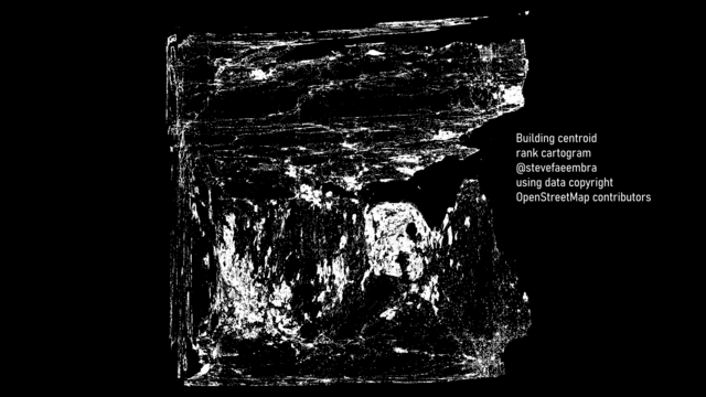
This weird looking thing is a pseudo-cartogram of #scotland. Using #qgis, #spatialite and data copyright #openstreetmap contributors.
Each building's x coordinate is its rank over the longitudes, y coordinate is its rank over the latitudes. Then projected to EPSG:3857 as a 1400 x 1400km square.
The blob on the left is Glasgow, the blob on the right is Edinburgh
#scotland #qgis #spatialite #OpenStreetMap
Edwin Wisse · @wisze
13 followers · 18 posts · Server fosstodon.org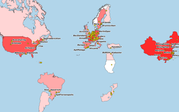
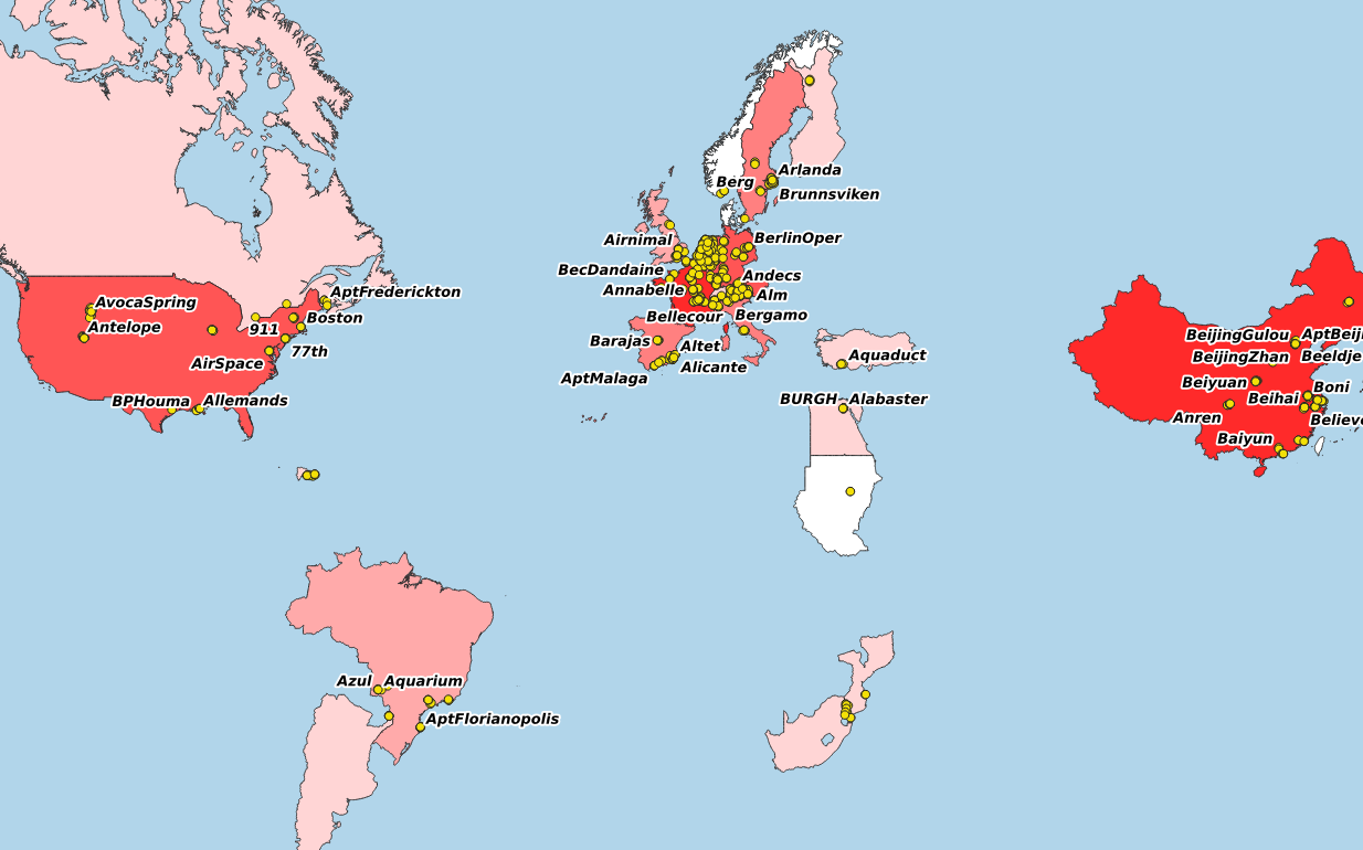
Met #qgis en #spatialite heb je alles waar je ooit een gis systeem voor nodig had. En het werkt beter ook. Omdat het open source is is er een hele gemeenschap die de foutjes eruit poetst. Ik gebruik het thusi om bij te houden waar ik allemaal geweest ben. Hieronder een wereldkaart met de landen die ik de laatste 20 jaar bezocht, een kaartje van m'n recente ritten door de Eifel en een kaartje met mijn sporen in 2023.

Chris Amico · @chrisamico
139 followers · 464 posts · Server journa.hostTIL how to use a spatial index with an attached database in #spatialite https://github.com/eyeseast/til/blob/main/sql/cross-database-spatial-index.md Going to be very handy.

Francesco P Lovergine · @gisgeek
10 followers · 18 posts · Server floss.socialSandro Furieri is the main author of #spatialite, a geospatial database based on #sqlite, released in 2008 for the first time.
Thanks that, here we manage a growing (now 48GBs) multi-years and multi-sites in-field soil moisture database, for scientific use. Thanks Sandro and Spatialite/Sqlite folks.
#spatialite #SQLite #GIS #FOSS4G

Paolo Melchiorre · @paulox
845 followers · 990 posts · Server fosstodon.orgI finally updated the first article on web maps with Django and SpatiaLite (SQLite) that I wrote in 2020. I tested the guide with Python 3.11, Django 4.1 and Ubuntu 22.10 and made some small improvements. ✨
I hope you find it interesting. 🤞
Any feedback is welcome. ✅
Happy reading. 👍
https://www.paulox.net/2020/12/08/maps-with-django-part-1-geodjango-spatialite-and-leaflet/
#python #django #map #spatialite #sqlite #geodjango #gis

Paolo Melchiorre · @paulox
481 followers · 295 posts · Server fosstodon.org
I wrote a series of #articles on how to build #maps with #Django 🗺️
The first article in the series is "Maps with Django (1): GeoDjango, SpatiaLite, Leaflet" 🍃
A quickstart #guide to create a #webmap with the #Python based web framework Django using its module #GeoDjango, the #SQLite database with its spatial extension #SpatiaLite and #Leaflet, a #JavaScript library for interactive maps. 👇
https://www.paulox.net/2020/12/08/maps-with-django-part-1-geodjango-spatialite-and-leaflet/
#articles #maps #django #guide #webmap #python #geodjango #sqlite #spatialite #leaflet #javascript
Paolo Melchiorre · @paulox
481 followers · 295 posts · Server fosstodon.orgI've just published:
"Maps with Django (part 1): GeoDjango, SpatiaLite and Leaflet"
A quickstart guide to create a web #map 🗺️ with #Django 🦄 using its module #GeoDjango 🌍, the #SQLite 🪶 database with its spatial extension #SpatiaLite 🌐 and #Leaflet 🍃
https://www.paulox.net/2020/12/08/maps-with-django-part-1-geodjango-spatialite-and-leaflet/
#django #spatialite #map #sqlite #leaflet #geodjango

UjuBib · @UjuBib
347 followers · 4509 posts · Server mamot.fr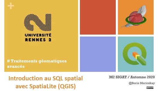
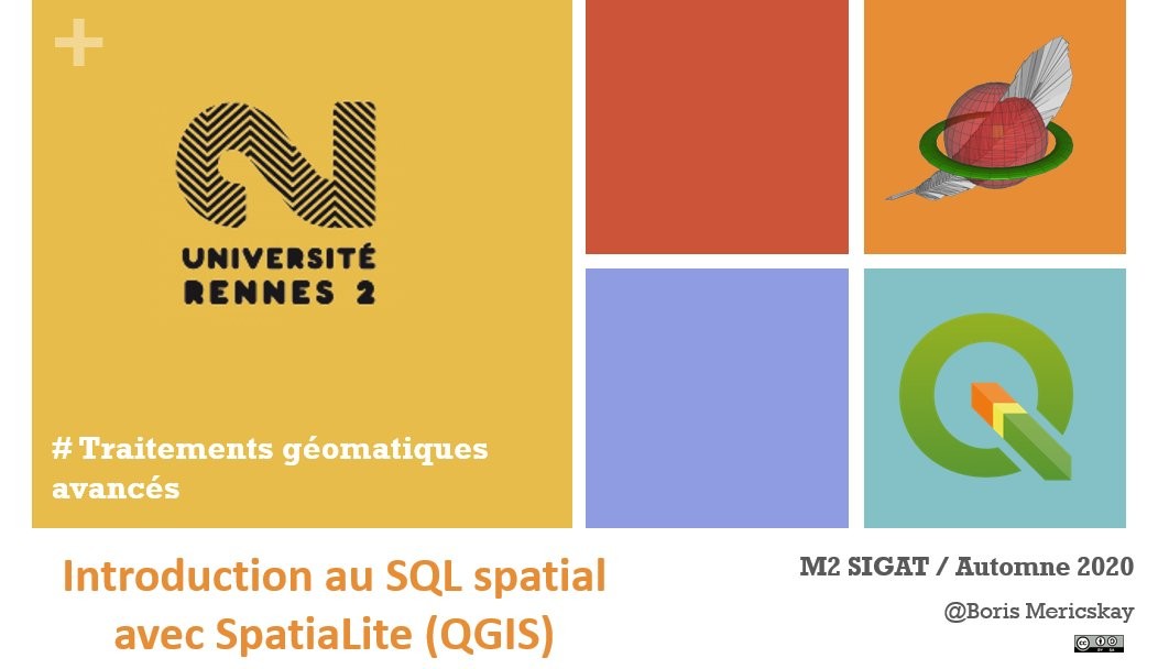
RT @BorisMericskay@twitter.com
Envie de se mettre au SQL où de re(découvrir) les possibilités de ce langage extraordinaire pour manipuler et analyser des données géographiques.
✅ Support de cours de 12h d'introduction au SQL spatial avec #SpatiaLite dans @qgis@twitter.com (200 slides en .pdf)
➡https://www.sites.univ-rennes2.fr/mastersigat/Cours/SeanceQSpatiaLite2.pdf
🐦🔗: https://twitter.com/BorisMericskay/status/1309018825510322178