
-karlos- 𓄿 · @karlos
381 followers · 1722 posts · Server en.osm.town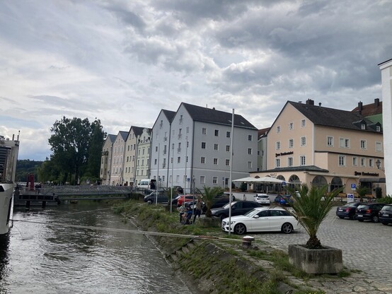
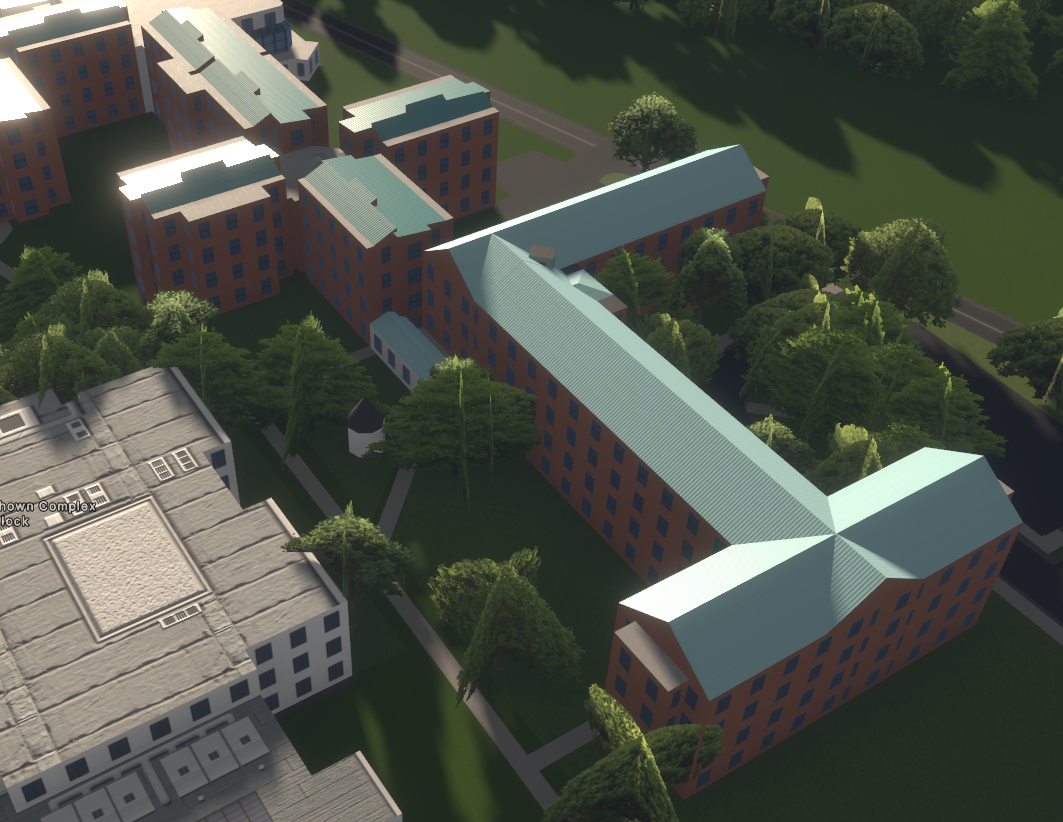
Comparing a group of buildings in #Passau, Germany
rendered by #StreetsGL and #OSM2World with reality
Both #OSM tools are done in #typescript
Is there a fan of #OpenStreetMap that knows #babylonjs well
and likes to help optimising our 3D renderer front-end?
#passau #streetsgl #osm2world #OSM #typescript #OpenStreetMap #babylonjs

Luis Falcon · @meanmicio
397 followers · 825 posts · Server todon.eu
-karlos- 𓄿 · @karlos
375 followers · 1690 posts · Server en.osm.town
The #OpenStreetMap 3D renderer #StreetsGL is now in the slippy map of www.OSMgo.org context menu (down right) next to the other ones.
-karlos- 𓄿 · @karlos
357 followers · 1607 posts · Server en.osm.town@stroughtonsmith After times, all this will come up with the #VisionPro : #GoogleEarth #MapBox
and also, as i strongly hope #OpenStreetMap with #MapLibre and #StreetsGL
#visionpro #googleearth #mapbox #OpenStreetMap #maplibre #streetsgl
-karlos- 𓄿 · @karlos
353 followers · 1592 posts · Server en.osm.town
#StreetsGL could take some ideas from #OpenStreetMap user tordans. See also this:
https://www.openstreetmap.org/user/tordans/diary/397212

· @barefootstache
177 followers · 1005 posts · Server en.osm.town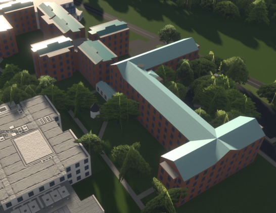
#MappingChallenge (Day 305/365)
Here some progress into #3d mapping #BrockUniversity.
Summary:
- JOSM: 38
- SCEE: 1
#MappingChallenge #3d #brockuniversity #OpenStreetMap #streetsgl
· @barefootstache
174 followers · 995 posts · Server en.osm.town
-karlos- 🗺 🛸 · @karlos
349 followers · 1533 posts · Server en.osm.town
Herrnhausen Hanover
https://streets.gl/#52.39116,9.69891,11.75,13.75,1562.85
#OpenStreetMap #StreetsGL looks good
and will get even better, when it will show barrier=hedge

David Coombe · @david_coombe_cbr
105 followers · 405 posts · Server aus.social
I just ran the sun across the sky as if it was 1844!
Where did the shadows fall? (Albeit from modern buildings not historical ones.) This helps solve a question of a colonial artist painting the streets with the sun seeming to shine from the south. I can see eventual potential for historical streetscapes.
Image: screenshot of 3D map of Adelaide, South Australia showing shadow animation for 10 August 1844
Run it on desktop or laptop: https://streets.gl/#-34.92467,138.59914,46.31,0.00,2549.12
Introductory article to this new tool: "Streets GL — a new 3D renderer for OSM": https://community.openstreetmap.org/t/streets-gl-a-new-3d-renderer-for-osm/98594
#streetsgl #openstreetmap #openhistoricalmap #adelaide
-karlos- 🗺 🛸 · @karlos
348 followers · 1532 posts · Server en.osm.townSchwerin Castle / Schweriner Schloss - Germany
#StreetsGL #OpenStreetMap #3DRendering
Animation recording (is hard with 7 FPS, and no macOS-keys)
https://streets.gl/#53.62439,11.41842,6.50,349.00,435.26
#streetsgl #OpenStreetMap #3drendering

Michael Brandtner · @MBrandtner
322 followers · 1663 posts · Server gruene.social
Ist dieses 3D-Rendering des Kieler Rathauses nicht beeindruckend? Wie sieht es denn aus, wenn wir die Kamera um 180 Grad drehen? Oh... #OpenStreetMap #3D #StreetsGL
-karlos- 🗺 🛸 · @karlos
348 followers · 1530 posts · Server en.osm.town
Das mit dem Penthaus ist ok, aber schon „tagging for the renderer“ und sollte mit 2 :parts gelöst werden; schließlich HAT das building 5 level.
Aber ja, #StreetsGL ist toll. Dabei ist #OpenStreetMap noch lange nicht ausgeschöpft: VR-Brille und multi-user, in world editing, indoor, Simulatoren von Autorennen bis Zeppelin, …
#streetsgl #OpenStreetMap #munchen #munich #3drendering
-karlos- 🗺 🛸 · @karlos
338 followers · 1497 posts · Server en.osm.town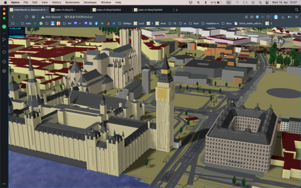
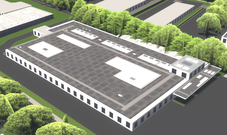
Comparing
#OSM2Word (Anyting in 3D, usable vor VR-Devices)
with the new
#StreetsGL (Like #F4Map, 3D on 2D, terrain)
#OpenStreetMap #3DRendering
London City
#osm2word #streetsgl #F4Map #OpenStreetMap #3drendering