
Jan Fries · @JanFries
5 followers · 3 posts · Server mapstodon.space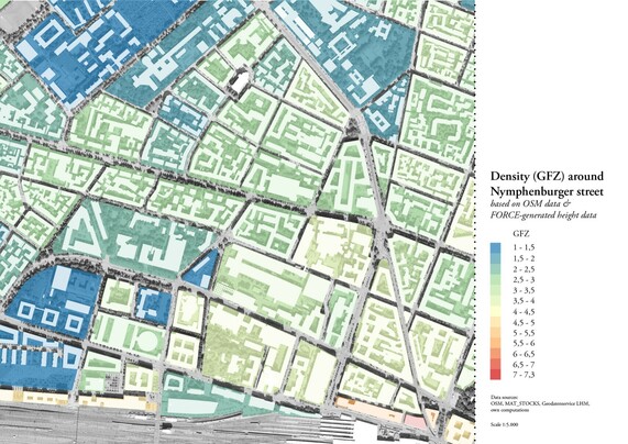
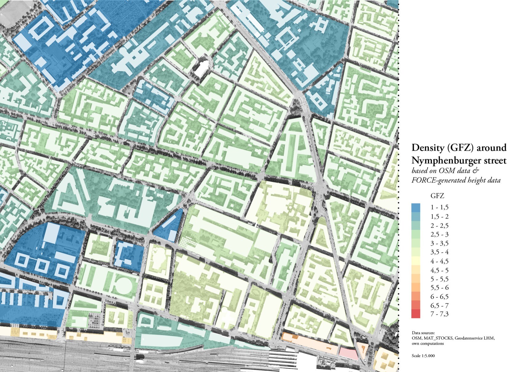
#30DayMapChallenge
Late Day 26: Islands
Although blocks in a city can be very different, they may end up creating a more or less homogenous image if measured by a sole indicator. There might be a bigger lesson hidden close by...
Also fascinating how, at the same time, you can get very close to built reality using broad generalisations.
> floor height assumed to be generally 3.5 m
> building height ai-generated from aerial imagery and generalised to 10m squares
#30DayMapChallenge #urbanform #stretchingthetheme
Last updated 3 years ago