GregCocks · @GregCocks
398 followers · 433 posts · Server techhub.socialGeomorphometry - A Brief Guide
--
https://doi.org/10.1016/S0166-2481(08)00001-9 <-- shared paper
--
https://geomorphometry.org/ <-- International Society for Geomorphometry home page
--
#GIS #spatial #mapping #elevation #remotesensing #data #digital #civilengineering #science #visualization #geometry #military #algorithms #society #visualisation #model #modeling #geomorphology #landcover #geomorphometry #quantitative #landsurface #analysis #spatialanalysis #spatiotemporal #terrainanalysis #physicalgeography #geography #geology #topography #landforms #watersheds #surfacemodel #algorithms #interpretation #gischat
#gis #spatial #mapping #elevation #remotesensing #data #digital #civilengineering #science #visualization #geometry #military #algorithms #society #visualisation #model #modeling #geomorphology #landcover #geomorphometry #quantitative #landsurface #analysis #spatialanalysis #spatiotemporal #terrainanalysis #PhysicalGeography #geography #geology #topography #landforms #watersheds #surfacemodel #interpretation #gischat
Jorge Cornejo :lah: :zac: · @xchido
4 followers · 6 posts · Server ataricafe.comOpening a 1.7G DXF surface model with :qgis: QGIS because Autodesk software could not even show a preview!
#FOSSforTheWin
#QGIS #Civil3D #ACAD #Autodesk #DXF #SurfaceModel
#qgis #acad #civil3d #fossforthewin #autodesk #dxf #surfacemodel
geoObserver · @geoObserver
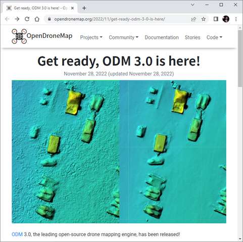
238 followers · 154 posts · Server mastodon.socialOpenDroneMap Released, jetzt v3.0 https://geoobserver.wordpress.com/2022/11/29/opendronemap-released-jetzt-v3-0/ via @berttemme @OpenDroneMap #WebODM #3d #pointcloud #3DModel #Orthomosaic #SurfaceModel #fossgis #foss4g #gistribe #opensource #spatial #geospatial #gis #geo #geoObserver
#WebODM #3d #pointcloud #3dmodel #orthomosaic #surfacemodel #fossgis #foss4g #gistribe #opensource #spatial #geospatial #gis #geo #geoobserver


