Thomas Weibel · @thomasweibel
458 followers · 2289 posts · Server swiss.socialProjekt #swisspeaX: Die Schweiz in 3D. https://www.thomasweibel.ch/swisspeax/ #vr #opendata #openglam #geodata #swisstopo #aframe #javascript @OpendataCH @OpenDataZurich @opendata @amicale.net @OpenDataZH
#swisspeax #vr #opendata #openglam #geodata #swisstopo #aframe #javascript
Pirmin Kalberer · @implgeo
299 followers · 84 posts · Server mapstodon.spaceBegründung für 7.2 Mio. Freihänder von #Swisstopo an #ESRI ist ziemlich dürftig. Und die Wartungskosten von ~1 Mio./J. werden dann erst recht freihändig vergeben. Aber wer will sich schon mit einer Beschwerde die Finger verbrennen... #SwissGIS #opensource #VendorLockin
https://www.simap.ch/shabforms/servlet/Search?EID=7&NOTICE_NR=1348365
#swisstopo #esri #swissgis #opensource #vendorlockin
loleh 💾 · @loleg
283 followers · 512 posts · Server fosstodon.orgThomas Weibel · @thomasweibel
389 followers · 1663 posts · Server swiss.socialDie Hypertext Markup Language ist die Sprache des World Wide Web. Mit HTML und Javascript lassen sich Anwendungen erstellen, die wie gewöhnliche Webseiten geladen werden, aber Erstaunliches leisten. Zum Beispiel Berggipfel bestimmen. https://blog.fhgr.ch/blog/mont/ #swisstopo #opendata @OpendataCH @OpenDataZurich
Thomas Weibel · @thomasweibel
365 followers · 1401 posts · Server swiss.social@Vorinstanz Diese verflixte Zwei kenne ich nur zu gut. https://www.thomasweibel.ch/?post=mont-2 #opendata #swisstopo
David Oesch · @davidoesch
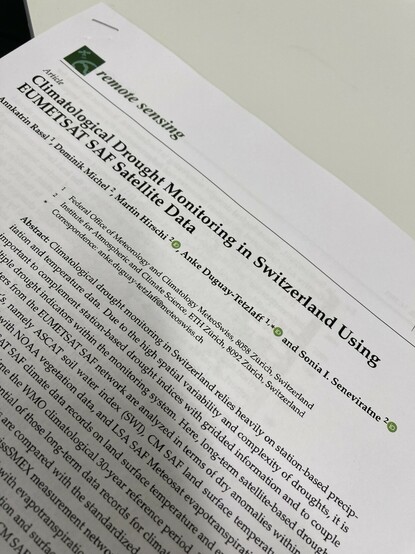
111 followers · 36 posts · Server mastodon.socialTaste of things to come: really looking forward to start in May in a new role at #swisstopo : remote sensing specialist drought. Any must reads and links to stay up to date in this field? @LadiesOfLandsat #sistersofsar #earthobservation #satellite #drought
#drought #swisstopo #sistersofsar #earthobservation #satellite
Thomas Weibel :verified: · @thomasweibel
294 followers · 486 posts · Server swiss.socialFür alle, die hoch hinaus wollen: Ein Höhenmesser für unterwegs. https://www.thomasweibel.ch/altiswiss/ #opendata #swisstopo #javascript @OpendataCH @OpenDataZurich
#opendata #swisstopo #javascript
Luke Seelenbinder🇨🇭🇪🇪🇺🇸 · @ls
78 followers · 65 posts · Server hachyderm.io…and it gets better. I'm afraid I may be spamming these images for a few days (while they continue generating…).
#swisstopo #Maps #aerialimagery #imagery
Luke Seelenbinder🇨🇭🇪🇪🇺🇸 · @ls
77 followers · 64 posts · Server hachyderm.ioJust 😍
I couldn't wait, so here's a work-in-progress #mosaic of #SwissTOPO aerial imagery. All thanks to #Python, #RasterIO, #GDAL, and a few late night coding sessions.
I can't get over the quality of these images, especially that water. ✨
#mosaic #swisstopo #python #Rasterio #gdal
Alexander 🐘 · @alexs77
220 followers · 1314 posts · Server mas.toGibt's im Web nichts offizielles, was zur #SwissTopo App vergleichbar ist und wo man Routen planen kann?
https://map.geo.admin.ch/?lang=de&topic=ech&bgLayer=ch.swisstopo.pixelkarte-farbe&E=2724574.75&N=1117021.13&zoom=5&layers=ch.swisstopo.zeitreihen,ch.bfs.gebaeude_wohnungs_register,ch.bav.haltestellen-oev,ch.swisstopo.swisstlm3d-wanderwege,ch.astra.wanderland-sperrungen_umleitungen&layers_visibility=false,false,true,true,false&layers_opacity=1,1,1,0.8,0.8&layers_timestamp=18641231,,,, ist ja gut, aber eben nur zum gucken. Bzw, ja, klar, man kann zeichnen - aber #Routenplanung?
Cédric Jeanneret :blobwave: · @Daemon
33 followers · 134 posts · Server social.tengu.chBon, fait que j'aille fouiller #Swisstopo et #veloland pour trouver des pistes de #descente #VTT dans mon coin. Ca démange, et la saison sera vite là.
Si d'un coup vous avez des #pistes dans le #jura #suisse, "à vot'bon cœur m'sieurs'dames" 🥹
#swisstopo #veloland #descente #vtt #pistes #jura #suisse
andreas, der tapfere · @andreas
48 followers · 285 posts · Server swiss-talk.net@alexs77
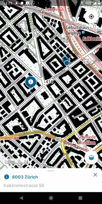
Auf der #SwissTopo-App ist der direkte Weg gar nicht eingezeichnet.
Wird wohl so ein abkürzender Trampelpfad sein, der dem Grundstückbesitzer missfällt, aber auf OSM trotzdem erfasst ist.
Alexander 🐘 · @alexs77
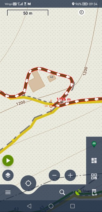
217 followers · 1216 posts · Server mas.toManchmal ist die Routenführung schon seltsam.
Warum schlägt #swisstopo da wohl diesen Umweg vor? Seltsam.
https://link.locusmap.app/t/mm3hsu
https://web.locusmap.app/loc/47.04160:8.50795:Rigiweg%2040,%20Arth
Sander Meijer · @bergmeister
121 followers · 323 posts · Server mountains.socialIf you plan hiking or mountaineering trips in Switzerland I can highly recommend the apps and/or website of Swisstopo:
Android: https://play.google.com/store/apps/details?id=ch.admin.swisstopo
iOS: https://apps.apple.com/us/app/swisstopo/id1505986543
Web: https://map.geo.admin.ch
The world-renowned Swiss maps are available for everyone to use. In the mobile apps you can easily plan routes, it shows you elevation gain/loss, expected hiking time, location, etc. For offline use, you can download the part of the map you need to your phone.
Thomas Weibel :verified: · @thomasweibel
242 followers · 308 posts · Server swiss.socialIm Frühtau zu Berge: MONT ist eine Augmented-Reality-Webapp für iPhones (iOS only), die sämtliche Hügelkuppen und Berggipfel der Schweiz einschliesslich Höhe und Distanz angibt. Die App basiert auf #Opendata, nutzt ein flat-file-Datenmodell und ist in #VanillaJS geschrieben. #swisstopo
Mehr: https://www.thomasweibel.ch/?post=mont-2
App: https://www.thomasweibel.ch/mont2
#opendata #vanillaJS #swisstopo
Ralph Straumann (@rastrau) · @rastrau
178 followers · 15 posts · Server mstdn.socialStänderat bewilligt 37 Millionen für #Swisstopo-Modernisierung:
https://www.inside-it.ch/staenderat-bewilligt-37-millionen-fuer-swisstopo-modernisierung-20221214
Ralph Straumann (@rastrau) · @rastrau
243 followers · 143 posts · Server mstdn.socialStänderat bewilligt 37 Millionen für #Swisstopo-Modernisierung:
https://www.inside-it.ch/staenderat-bewilligt-37-millionen-fuer-swisstopo-modernisierung-20221214
Thomas Weibel :verified: · @thomasweibel
220 followers · 239 posts · Server swiss.socialMit MONT Schweizer Berge und Hügel entdecken (iOS only): iPhone auf den Horizont richten, Namen sowie Gipfelhöhe und Entfernung ablesen. https://www.thomasweibel.ch/mont2/ #opendata #swisstopo #vanillaJS @OpendataCH
#opendata #swisstopo #vanillaJS
David Oesch · @davidoesch
29 followers · 3 posts · Server mastodon.socialOur „#geodata made easy” team won the #civicChallenge2022 public award ! - leveraging gov innovation #swisstopo #bfh_hesb #vbs_ddps thanks #pionierfonds @hannesgassert@bird.evilcyberhacker.net #AnjaWydenGuelpa we had a blast #civicinnovation
#geodata #civicchallenge2022 #swisstopo #bfh_hesb #vbs_ddps #pionierfonds #anjawydenguelpa #civicinnovation
Thomas Weibel :verified: · @thomasweibel
153 followers · 114 posts · Server swiss.social«Wie heisst der Berg da drüben? Und das Dorf da unten im Tal?» Antworten gibt mein Projekt «swisspeaX», das die Schweizer Topografie in VR nachbildet, #opensource und #opendata sei Dank. https://swisspeax.thomasweibel.ch #swisstopo @opendata
#OpenSource #opendata #swisstopo


