
Joseph Elfelt · @mappingsupport
444 followers · 345 posts · Server m.ai6yr.org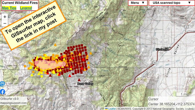
Interactive #GIS map for #ThompsonRidgeFire southern Utah.
Dark red symbols are MODIS and VIIRS satellite *heat* detections within prior 6 hours. Some detections might be smoke in the air but not (at least yet) fire on the ground. For more info click “Map tips” upper left corner.
#UTfire #UTwx #wildfire #Geospatial #Maps #Mapping #Leaflet #ArcGIS #WebMap
Open #GISsurfer map:
https://mappingsupport.com/p2/gissurfer.php?center=38.165204,-112.375374&zoom=12&basemap=USA_scanned_topo&overlay=VIIRS_7_day,MODIS_7_day,State_boundary,Fire_perimeter_NIFC&data=https://mappingsupport.com/p2/special_maps/disaster/USA_wildland_fire.txt
#gis #thompsonridgefire #utfire #utwx #Wildfire #geospatial #maps #mapping #leaflet #arcgis #webmap #gissurfer