GregCocks · @GregCocks
718 followers · 569 posts · Server techhub.socialExtensibility Of U-Net Neural Network Model For Hydrographic Feature Extraction And Implications For Hydrologic Modeling
--
https://doi.org/10.3390/rs13122368 <-- shared paper
--
#GIS #spatial #mapping #machinelearning #neuralnetwork #Unet #featureextraction #hydrography #hydrology #water #automation #remotesensing #surfacewater #NHD #bluelines #topography #deeplearning #AI #artificialintelligence #LiDAR #ifSAR #elevation #topography #ANN #HPC #model #modeling #trainingdata #Alaska #USA #watersheds #DTM #DSM #DEM #routing #network #D8 #maps #opendata #3dep #elevation #topography #USGS
#gis #spatial #mapping #machinelearning #neuralnetwork #unet #featureextraction #hydrography #hydrology #water #automation #remotesensing #surfacewater #nhd #bluelines #topography #deeplearning #AI #artificialintelligence #lidar #ifsar #elevation #ann #hpc #model #modeling #trainingdata #alaska #USA #watersheds #dtm #dsm #dem #routing #network #d8 #Maps #opendata #3dep #usgs
Jer 🚵🏼 · @jerzone
219 followers · 2213 posts · Server techhub.socialScenes from morning hike with my sis. Not shown: heavy fog and humidity! Not their usual Wyoming fare.
#hiking #NewHampshire #mushrooms #topography
#hiking #newhampshire #mushrooms #topography
Kirsty Hooper · @KHGenealogy
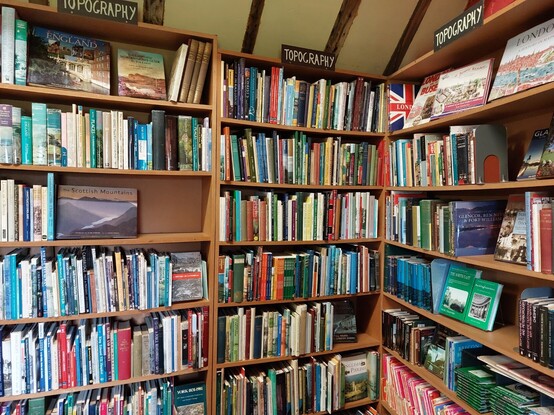
120 followers · 28 posts · Server genealysis.socialFor a #LocalHistory addict the #Topography corner @AstleyBookFarm is a very dangerous kind of heaven #OnePlaceStudies #AllAboutThatPlace
#localhistory #topography #oneplacestudies #allaboutthatplace
Hari Tulsidas :verified: · @haritulsidas
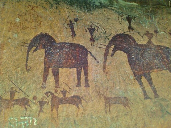
321 followers · 1601 posts · Server masto.aiPaleolithic art conveyed information about the landscape and resources, according to archaeologists who analyzed engravings and paintings from France and Spain. The art represented rivers, mountains, valleys, and other features, suggesting that ancient humans had sophisticated communication skills and used art to share knowledge and enhance survival.#paleolithic #art #topography https://phys.org/news/2023-08-topographical-elements-paleolithic-art-revealed.html?utm_source=flipboard&utm_content=HariTulsidas%2Fmagazine%2FMind+and+Matter
GregCocks · @GregCocks
576 followers · 515 posts · Server techhub.socialThe Kingdom of Bhutan [1965 cartography]
--
https://collections.lib.uwm.edu/digital/collection/agdm/id/30617/rec/61 <-- link to map and details
--
https://doi.org/10.1111/j.1467-8306.1965.tb00539.x <-- shared paper’s note, 2010
--
H/T @evan Applegate
[a “yam between two boulders.” (China (Tibet) and India)]
“Contained in (work): Association of American Geographers Annals of the Association of American Geographers…
Relief shown by shading and spot heights…”
#GIS #spatial #mapping #bhutan #kingdomofbhutan #map #cartographer #cartography #topography #relief #transportation #seasia #hydrology #historic #historicmaps #landform #geomorphology #terrain #gischat #AAG
@americangeo
#gis #spatial #mapping #bhutan #kingdomofbhutan #map #cartographer #cartography #topography #relief #transportation #seasia #hydrology #historic #historicmaps #landform #geomorphology #terrain #gischat #aag
Vorropohaiah 🌍✏️📖 · @Vorropohaiah
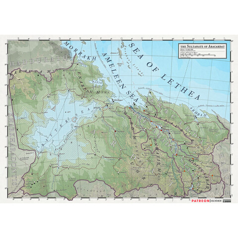
84 followers · 350 posts · Server mas.toABACARDAT
Link in bio
.
#map #design #photoshop #art #topography #mapart #elyden #fantasyatlas #fantasymap #atlasmap #fantasycartography #rpg #dnd #worldbuilding #fantasy #campaignsetting #patreon #fantasyworld
#fantasyworld #patreon #campaignsetting #fantasy #worldbuilding #dnd #rpg #fantasycartography #atlasmap #fantasymap #fantasyatlas #elyden #mapart #topography #art #photoshop #design #map
Vorropohaiah 🌍✏️📖 · @Vorropohaiah
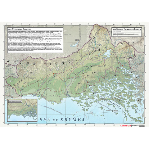
82 followers · 348 posts · Server mas.toLIMOTH
Link in bio
.
#map #design #photoshop #art #topography #mapart #elyden #fantasyatlas #fantasymap #atlasmap #fantasycartography #rpg #dnd #worldbuilding #fantasy #campaignsetting #patreon #fantasyworld
#fantasyworld #patreon #campaignsetting #fantasy #worldbuilding #dnd #rpg #fantasycartography #atlasmap #fantasymap #fantasyatlas #elyden #mapart #topography #art #photoshop #design #map
Vorropohaiah 🌍✏️📖 · @Vorropohaiah
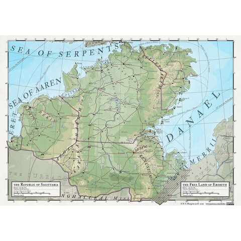
82 followers · 347 posts · Server mas.toSAGITTARIA
Link in bio
.
#map #design #photoshop #art #topography #mapart #elyden #fantasyatlas #fantasymap #atlasmap #fantasycartography #rpg #dnd #worldbuilding #fantasy #campaignsetting #patreon #fantasyworld
#fantasyworld #patreon #campaignsetting #fantasy #worldbuilding #dnd #rpg #fantasycartography #atlasmap #fantasymap #fantasyatlas #elyden #mapart #topography #art #photoshop #design #map
Vorropohaiah 🌍✏️📖 · @Vorropohaiah
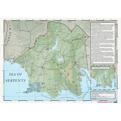
82 followers · 346 posts · Server mas.toOPHIUSSA
Link in bio
.
#map #design #photoshop #art #topography #mapart #elyden #fantasyatlas #fantasymap #atlasmap #fantasycartography #rpg #dnd #worldbuilding #fantasy #campaignsetting #patreon #fantasyworld
#fantasyworld #patreon #campaignsetting #fantasy #worldbuilding #dnd #rpg #fantasycartography #atlasmap #fantasymap #fantasyatlas #elyden #mapart #topography #art #photoshop #design #map
Vorropohaiah 🌍✏️📖 · @Vorropohaiah
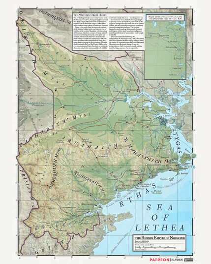
81 followers · 344 posts · Server mas.toNOAVATUR
Link in bio
.
#map #design #photoshop #art #topography #mapart #elyden #fantasyatlas #fantasymap #atlasmap #fantasycartography #rpg #dnd #worldbuilding #fantasy #campaignsetting #patreon #fantasyworld
#fantasyworld #patreon #campaignsetting #fantasy #worldbuilding #dnd #rpg #fantasycartography #atlasmap #fantasymap #fantasyatlas #elyden #mapart #topography #art #photoshop #design #map
GregCocks · @GregCocks
497 followers · 463 posts · Server techhub.socialMapped - What Did The World Look Like In The Last Ice Age?
--
https://www.visualcapitalist.com/cp/mapped-world-the-last-ice-age/ <-- shared article
--
https://doi.org/10.1038/s41586-021-03467-6 <-- shared paper
--
#GIS #spatial #mapping #model #modeling #iceage #LastGlacialMaximum #sealevel #glaciers #ice #visualisation #LGM #lasticeage #earthhistory #climate #climatechange #map #cartography #research #elevation #topography #remotesensing #opendata #global #poles #polar #pole #icemass #iceandsnow
#VisualCapitalist @visualcapitalist
#gis #spatial #mapping #model #modeling #iceage #lastglacialmaximum #sealevel #glaciers #ice #visualisation #lgm #lasticeage #earthhistory #climate #climatechange #map #cartography #research #elevation #topography #remotesensing #opendata #global #poles #polar #pole #icemass #iceandsnow #visualcapitalist
GregCocks · @GregCocks
398 followers · 433 posts · Server techhub.socialGeomorphometry - A Brief Guide
--
https://doi.org/10.1016/S0166-2481(08)00001-9 <-- shared paper
--
https://geomorphometry.org/ <-- International Society for Geomorphometry home page
--
#GIS #spatial #mapping #elevation #remotesensing #data #digital #civilengineering #science #visualization #geometry #military #algorithms #society #visualisation #model #modeling #geomorphology #landcover #geomorphometry #quantitative #landsurface #analysis #spatialanalysis #spatiotemporal #terrainanalysis #physicalgeography #geography #geology #topography #landforms #watersheds #surfacemodel #algorithms #interpretation #gischat
#gis #spatial #mapping #elevation #remotesensing #data #digital #civilengineering #science #visualization #geometry #military #algorithms #society #visualisation #model #modeling #geomorphology #landcover #geomorphometry #quantitative #landsurface #analysis #spatialanalysis #spatiotemporal #terrainanalysis #PhysicalGeography #geography #geology #topography #landforms #watersheds #surfacemodel #interpretation #gischat
Jer 🚵🏼 · @jerzone
175 followers · 1701 posts · Server techhub.socialAnother angle with a printed frame. I love how printing in this orientation layers become contour lines that you can trace between trails to compare elevations. Speaking of which, elevation is exaggerated about 3x, which I think does a nice job highlighting glacial artifacts of the area along with giving a sense of climbing effort for a given trail.
#3dprinting #mtb #gis #Maps #topography
Vorropohaiah 🌍✏️📖 · @Vorropohaiah
81 followers · 344 posts · Server mas.toOCEAN CURRENTS OF ELYDEN
https://www.patreon.com/posts/69281557?utm_campaign=postshare_creator
.
#worldbuilding #map #photoshop #topography #mapart #elyden #fantasyatlas #fantasymap #atlasmap #sciencefantasy #fantasycartography #fantasyart #vorropohaiah #rpg #dnd #fantasy #scifi #fantasyworld #amwriting #authors #wip
#wip #authors #amwriting #fantasyworld #scifi #fantasy #dnd #rpg #vorropohaiah #fantasyart #fantasycartography #sciencefantasy #atlasmap #fantasymap #fantasyatlas #elyden #mapart #topography #photoshop #map #worldbuilding
GregCocks · @GregCocks
297 followers · 389 posts · Server techhub.socialTopoPyScale: - A Python Package for Hillslope Climate Downscaling
--
https://doi.org/10.21105/joss.05059 <-- shared paper
--
#GIS #spatial #mapping #python #climatechange #development #energy #complexity #spatialanalysis #spatiotemporal #remotesensing #pythonfordatascience #model #modeling #global #reanalyses #resampling #topography #TopoPyScale #mountain #water #hydrology #geomorphology #cryosphere #glacier #glacial #atmosphere #datadensity #landsurface #opensource
#gis #spatial #mapping #python #climatechange #development #energy #complexity #spatialanalysis #spatiotemporal #remotesensing #pythonfordatascience #model #modeling #global #reanalyses #resampling #topography #topopyscale #mountain #water #hydrology #geomorphology #cryosphere #glacier #glacial #atmosphere #datadensity #landsurface #opensource
GregCocks · @GregCocks
297 followers · 386 posts · Server techhub.socialPost-Subduction Tectonics Induced By Extension From A Lithospheric Drip
--
https://doi.org/10.1038/s41561-023-01201-7 <-- shared paper
--
#GIS #spatial #mapping #formation #mechanical #data #geology #structuralgeology #platetectonics #subduction #tectonics #lithosphere #model #modeling #Borneo #magmatism #topography #uplift #Malysia #spatialanalysis #remotesensing #seismology #seismic #geophysics #gravity #gravational #volcanic #vulcanism #arc #simulation #simulations #crust #mantle #continent #orogeny
#gis #spatial #mapping #formation #mechanical #data #geology #structuralgeology #platetectonics #subduction #tectonics #lithosphere #model #modeling #borneo #magmatism #topography #uplift #malysia #spatialanalysis #remotesensing #seismology #seismic #geophysics #gravity #gravational #volcanic #vulcanism #arc #simulation #simulations #crust #mantle #continent #orogeny
m naudin · @Mnaudin
919 followers · 197 posts · Server piaille.fr#science #montagne #mountain #topographie #topography
Cette infographie répond à la question : « Quel est le point le plus élevé sur notre Terre 🌍 ? ».
En fait, il y en a trois, tout dépend du point d'origine considéré :
- Si l'on mesure par rapport au niveau de la mer : c'est le mont Everest🇳🇵(Népal)
- Si l'on mesure par rapport à la base de la montagne : c'est le mont Mauna Kea 🇺🇲 (États-Unis)
- Si l'on mesure par rapport au centre de la Terre : c'est le mont Chimborazo 🇪🇨 (Équateur)
#Science #montagne #mountain #topographie #topography
· @stib
514 followers · 462 posts · Server aus.socialPro tip for anyone who happens to be looking for high resolution #bathymetry and #topography data. Nasa's publicly available images top out at 3.6k pixels wide, which might not be enough for say a detailed 3D model. But if you go to the web page where they're available e.g. https://neo.gsfc.nasa.gov/view.php?datasetId=GEBCO_BATHY and click one of the download links, it actually renders the data live. So if you hack the URL you can dial up any* resolution you want.
The URL for the bathymetry data for example ends with `&format=PNG&width=3600&height=1800`. If you want an image with say, 10 times the resolution, just add a zero to both dimensions.
*Not sure what the upper limit is, or what resolution the original data set is. Don't abuse it or it might get taken away.
#NoteForFutureSelf #blender3d #dataVis
#bathymetry #topography #noteforfutureself #blender3d #datavis
Vorropohaiah 🌍✏️📖 · @Vorropohaiah
77 followers · 331 posts · Server mas.tohttps://www.patreon.com/elyden
.
Want to learn more about Elyden? Become a patron and gain access to over 100 high-res maps, as well as the Encyclopaedia Elyden and the Atlas Elyden PDFs, which collectively clock in at over 1,000 pages, all for as little as $51 a year.
.
.
.
.
#worldbuilding #map #photoshop #topography #mapart #elyden #fantasyatlas #fantasymap #atlasmap #sciencefantasy #fantasycartography #fantasyart #vorropohaiah #rpg #dnd #fantasy #scifi #fantasyworld #amwriting #authors #wip
#wip #authors #amwriting #fantasyworld #scifi #fantasy #dnd #rpg #vorropohaiah #fantasyart #fantasycartography #sciencefantasy #atlasmap #fantasymap #fantasyatlas #elyden #mapart #topography #photoshop #map #worldbuilding
Michael Marten · @MichaelMarten
101 followers · 210 posts · Server todon.euStraight lines/Curved lines (a late contribution to #Fensterfreitag!)
This is a #window at the Topographie des Terrors museum in #Berlin: https://www.topographie.de/.
This complex houses an excellent exhibition about the ways in which Nazis developed control over Germany in the 1920s-30s-40s, as well as the aftermath of the Nazi era. It picks up on the very real #topography of the buildings that are now part of everyday Berlin, but were once used in the #Nazi-era for violence, persecution, and murder. I found it quite difficult to even think about making meaningful photographs here, but this window in the café, that looks into the other parts of the building (look at the website, it's the square in the middle), suggested something of the bleakness of the topics that were being addressed, and the ways in which things that are straight can be bent, much as clear truths can be bent to be deadly lies.
#Fensterfreitag #window #Berlin #topography #nazi


