Geewhizpat · @Geewhizpat
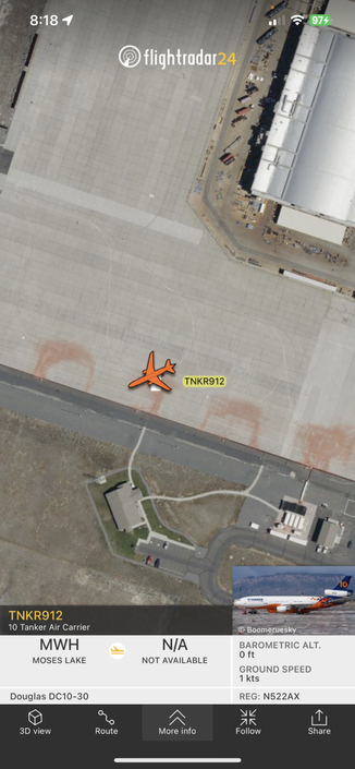
829 followers · 2566 posts · Server newsie.socialVLAT912 is “awake” transponder on in the retardant pits at Moses Lake fire base…probably prepping to fight the #tunnel5fire once AA lead aircraft is in the air and setting up ops…#avgeek #wildfire #Washingtonwildfire
#tunnel5fire #avgeek #wildfire #washingtonwildfire
Geewhizpat · @Geewhizpat
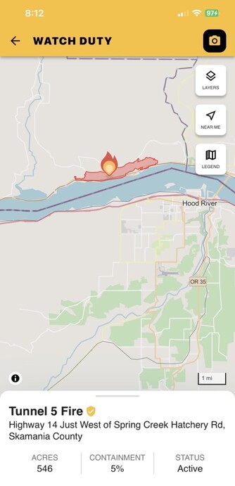
829 followers · 2566 posts · Server newsie.social#Tunnel5Fire is now 546 acres and remains 5% contained with most of the fire spread on the west end on steeper slopes. 372 personnel are assigned. 315 structures are threatened and 10 have been destroyed. A community meeting is being held tonight at 7pm in person at the White Salmon City Hall (100 N. Main Avenue, White Salmon, WA 98672) and on zoom at https://zoom.us/j/97290660491 Tunnel 5 Fire @ Highway 14 Just West of Spring Creek Hatchery Rd, Skamania County
#wawx #WashingtonWildfire
#tunnel5fire #wawx #washingtonwildfire
Geewhizpat · @Geewhizpat
829 followers · 2564 posts · Server newsie.social#CaineFire is now 546 acres and remains 5% contained with most of the fire spread on the west end on steeper slopes. 372 personnel are assigned. 315 structures are threatened and 10 have been destroyed. A community meeting is being held tonight at 7pm in person at the White Salmon City Hall (100 N. Main Avenue, White Salmon, WA 98672) and on zoom at https://zoom.us/j/97290660491 Tunnel 5 Fire @ Highway 14 Just West of Spring Creek Hatchery Rd, Skamania County - #Tunnel5Fire
#wawx #WashingtonWildfire
#cainefire #tunnel5fire #wawx #washingtonwildfire
Geewhizpat · @Geewhizpat
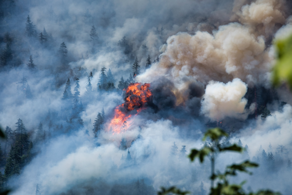
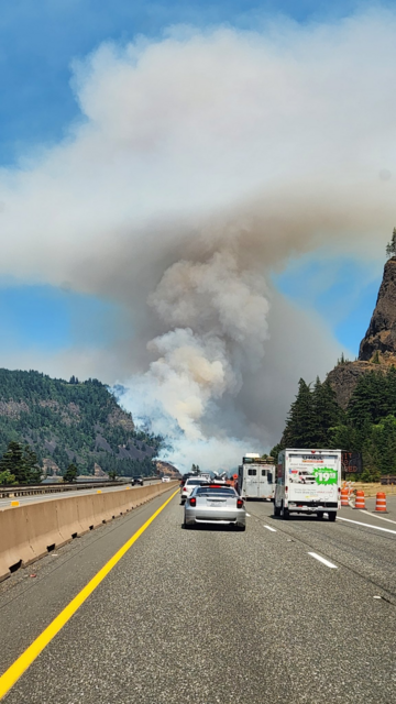
829 followers · 2561 posts · Server newsie.socialA #wildfire in #Washington State has destroyed at least 10 homes and forced evacuations #Tunnel5Fire near #Underwood, Washington in the Columbia River Gorge.
#HoodRiver, Oregon.Fire is on a very steep slope & heading north into a dense, heavily timbered drainage.
#wildfire #Tunnel5Fire #wawx #WashingtonWildfire
#wildfire #Washington #tunnel5fire #underwood #hoodriver #wawx #washingtonwildfire
Ryan Pollard :verified_paw: · @rdp
314 followers · 1587 posts · Server hachyderm.ioCompletely stressed out about the #Tunnel5Fire. Grandma's house is a short walk away from ACTIVE F***ING FLAMES and she won't leave. It's turning into a whole-family effort to get her out.
PSA: If you're in an evacuation zone, EE-VACK-YOU-ATE.
Joseph Elfelt · @mappingsupport
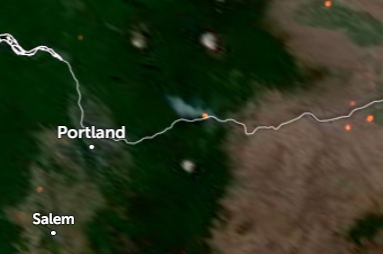
227 followers · 146 posts · Server m.ai6yr.orgJuly 3. #Tunnel5Fire near Underwood WA. Map shows MODIS/VIIRS satellite heat detection.
To read the fire weather forecast, open the map, click the map, scroll down in the data that appears and then follow the link.
The map has lots of #GIS fire related layers you can turn on/off/restack. The ‘top’ layer can be clicked to see attribute data. Need help? See 2 links upper left corner of the map. #WAfire #WAwx #Geospatial #ArcGIS #Leaflet
Open #GISsurfer map:
https://mappingsupport.com/p2/gissurfer.php?center=45.727244,-121.571102&zoom=14&basemap=USA_basemap&overlay=State_boundary,Wildland_fire_name,USA_main_contour_lines,MODIS_7_day,VIIRS_7_day,USA_roads,NOAA_fire_weather_forecast&data=https://mappingsupport.com/p2/special_maps/disaster/USA_wildland_fire.txt
#tunnel5fire #gis #wafire #wawx #geospatial #arcgis #leaflet #gissurfer
christina bowen · @christina
2212 followers · 1478 posts · Server social.coopThe fire that started earlier today along the Columbia River is now threatening over 100 homes and has tripled in size over the last six hours.
Sushimom · @sushimom
32 followers · 65 posts · Server kolektiva.social#Tunnel5Fire Has gone from an underbrush fire to the crowns of the trees.
This is really bad. It's progressing quickly.
Sushimom · @sushimom
32 followers · 64 posts · Server kolektiva.socialJoseph Elfelt · @mappingsupport
203 followers · 142 posts · Server m.ai6yr.org#Tunnel5Fire near Underwood WA, Skamania County.
Map shows first satellite heat detections. That data is not real time, locations are only approximate and sometimes ‘false positive’. To learn more about the limitations of the this data click “Map tips” link in upper left corner and read about MODIS and VIIRS. #WAfire #WAwx
Open #GISsurfer map:
https://mappingsupport.com/p2/gissurfer.php?center=45.724010,-121.578741&zoom=14&basemap=ESRI_aerial_newer&overlay=VIIRS_7_day,MODIS_7_day,State_boundary,Wildland_fire_name,Lake_river_stream&data=https://mappingsupport.com/p2/special_maps/disaster/USA_wildland_fire.txt
#tunnel5fire #wafire #wawx #gissurfer
Sushimom · @sushimom
32 followers · 62 posts · Server kolektiva.socialOne of my favorite placed the #ColumbiaRiverGorge is on fire, again. The #Tunnel5Fire is quickly spreading in steep terrain.
Not my pictures.
#columbiarivergorge #tunnel5fire
