
thebaldgeek · @thebaldgeek
372 followers · 118 posts · Server airwaves.social
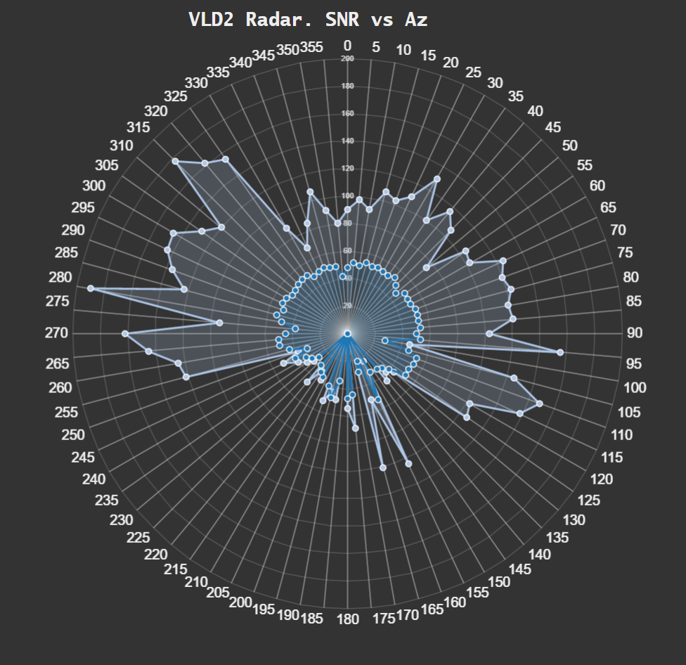
Finally got access to #chatgpt and got it to write some #javascript for me. A bit to calculate elevation of an aircraft and a bit to calc the normalized inverse square of a radio signal.
I put both bits in a function node in #nodered and plotted the result.
So now I have a radar plot of aircraft distance and signal strength to show changes to my #VHF #VDL2 station.
I could not have written this code, so its a pretty big deal in my books.
#chatgpt #javascript #nodered #vhf #vdl2

PC1I · @PC1I
66 followers · 82 posts · Server mastodon.radio

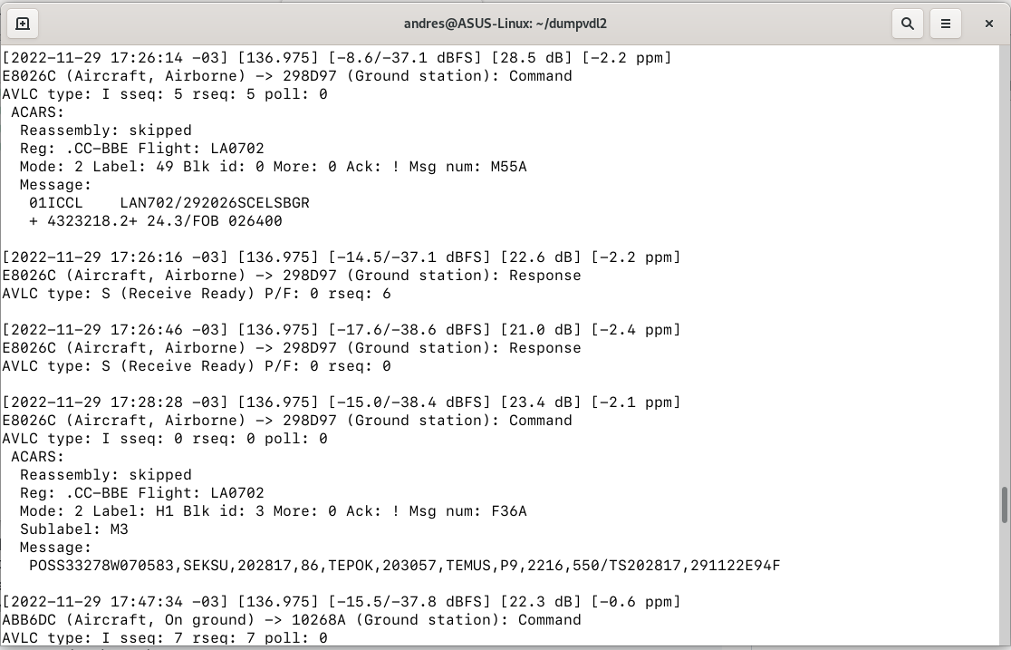
Andres Bahamondes :mastodon: · @bahamondes
55 followers · 226 posts · Server mastodon.social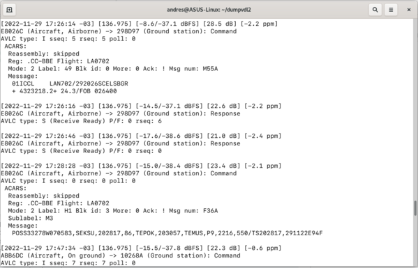

thebaldgeek · @thebaldgeek
29 followers · 65 posts · Server ioc.exchange
Here is a screenshot of lat/lon from aircraft plotted on a map.
There are two #ACARS stations here, #KLAS and #KPHX airports.
Using #nodered worldmap node and its heatmap to show traffic density.
Ok, just added one from the UK as well... a single #ACARS #VDL2 station in this case.
Keep in mind some of these aircraft will be using #ADSB, some wont <cough Elon /cough>.
#ACARS #klas #kphx #nodered #vdl2 #adsb