
SubtleBlade ⚔️ · @SubtleBlade
221 followers · 4413 posts · Server mastodon.scot'#Health alarm as tide of rotting #seaweed chokes #UK holiday #beaches'
'Potentially lethal to fish and dangerous for humans, the summer’s #toxic invader is caused by #WarmingSeas and strong winds'
''The Kent area also suffers from nutrient enrichment of coastal waters due to #sewage discharge as well as #AgriculturalRunOff.'
https://www.theguardian.com/environment/2023/aug/26/health-alarm-as-tide-of-rotting-seaweed-chokes-uk-holiday-beaches #ClimateCrisis #GlobalHeating #IntensiveFarming #Farming
#farming #IntensiveFarming #globalheating #climatecrisis #agriculturalrunoff #sewage #warmingseas #toxic #beaches #uk #seaweed #health

J.J. Angelus :mastoart: · @jj_angelus
18 followers · 91 posts · Server mstdn.socialGeneral Circulation Model (MIT GCM)
ECC02 simulates ocean flows at all depths, but only surface flows are used in this visualization. The global sea surface current flows are colored by corresponding sea surface temperatures. The sea surface temperature data is also from the ECC02 model...
You can read more here:
https://sos.noaa.gov/datasets/sea-surface-curre nts-and -temperature-vegetation-on-land/
CREDIT: NOAA
J.J. Angelus :mastoart: · @jj_angelus
18 followers · 91 posts · Server mstdn.social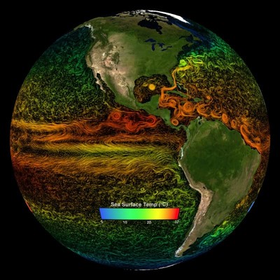
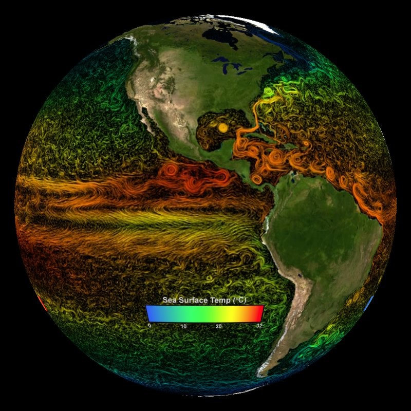
Global-Ocean and Sea-lce Data Synthesis
ECC02 produces increasingly accurate syntheses of all available global-scale ocean and sea-ice data at resolutions that start to resolve ocean eddies and other narrow current systems, which transport heat, and other properties within the ocean.
ECC02 data syntheses are created by using the available satellite and in-situ data in the Massachusetts Institute of Technology.
J.J. Angelus :mastoart: · @jj_angelus
18 followers · 91 posts · Server mstdn.socialA Thread : ⬇️
Global-scale Ocean and Sea Ice Data
Sea Surface Currents and Temperature
(vegetation on land).
To increase understanding and predictive capability for the ocean's role in future climate change scenarios, the NASA Modeling, Analysis, and Prediction (MAP) program has created a project called Estimating
the Circulation and Climate of the Ocean, Phase ll (ECC02):