
LabSpokane · @LabSpokane
340 followers · 1199 posts · Server mas.to
Evacuation zones #WestHalletFire #Spokane #wildfire
#wildfire #spokane #westhalletfire

Joseph Elfelt · @mappingsupport
418 followers · 315 posts · Server m.ai6yr.org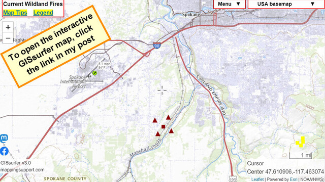
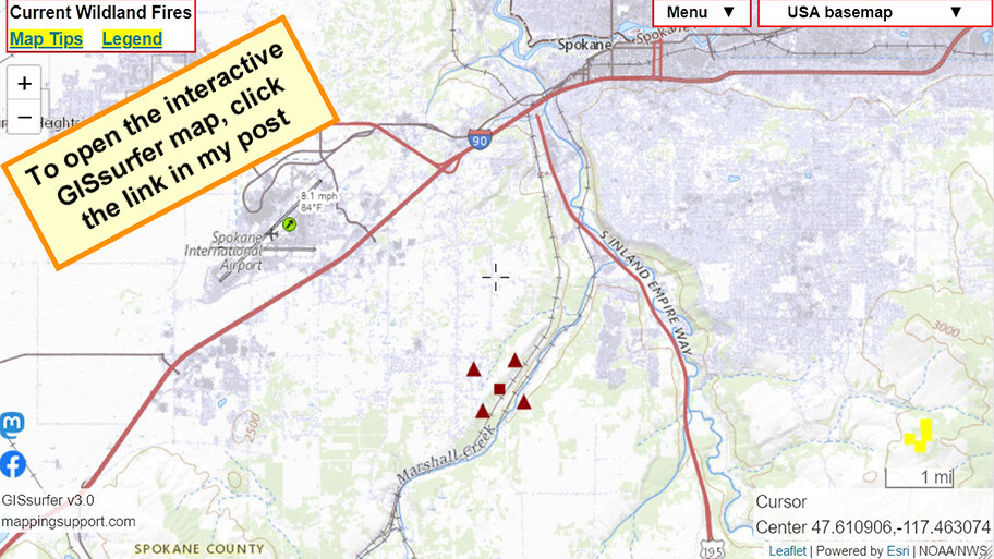
July 31 afternoon. Interactive #GIS map shows satellite *heat* detection for #WestHalletFire south side of Spokane WA.
Some heat detections are likely smoke in the air but not fire on the ground. But with that said, never rely on any map to ignore an order to evacuate.
Please read the “Map tips” link and “Legend” in upper left corner.
#WAfire #WAwx #wildfire #Geospatial #Maps #Mapping #Leaflet #ArcGIS #WebMap
Open #GISsurfer map:
https://mappingsupport.com/p2/gissurfer.php?center=47.610906,-117.463074&zoom=12&basemap=USA_basemap&overlay=VIIRS_7_day,MODIS_7_day,State_boundary,Wind_temperature_and_more...&data=https://mappingsupport.com/p2/special_maps/disaster/USA_wildland_fire.txt
#gis #westhalletfire #wafire #wawx #Wildfire #geospatial #maps #mapping #leaflet #arcgis #webmap #gissurfer