
Andrew Brown :rstats: · @humus_rocks
148 followers · 89 posts · Server fosstodon.org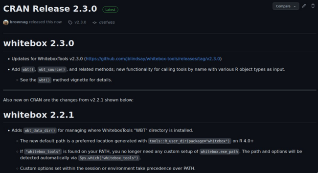
The {whitebox} #Rstats #Rspatial package has been updated for #WhiteboxTools v2.3.0 and is now available on CRAN!
#rstats #rspatial #whiteboxtools

Qiusheng Wu · @giswqs
187 followers · 32 posts · Server fosstodon.org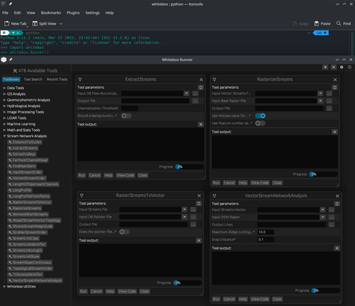
#WhiteboxTools v2.3.0 was released by Dr. John Lindsay yesterday. I have updated the #Python, #Jupyter, and #ArcGIS frontends accordingly 👇
Python: github.com/giswqs/whitebox-python
Jupyter: github.com/giswqs/whiteboxgui
ArcGIS: github.com/giswqs/WhiteboxTools-ArcGIS
For more info, visit whiteboxgeo.com
#whiteboxtools #python #jupyter #arcgis #opensource #geospatial

marwan_ito · @marwan_ito
7 followers · 13 posts · Server piaille.fr
Un bricolage qui traîne en machine depuis quelque temps... Petit jeu avec les outils de visualisation du rayonnement solaire et du #lidarhd de @ignfrance
Un workflow qui mobilise principalement #pdal et #WhiteBoxTools (algo TimeInDaylight du core #opensource).
Des tentatives à vocation essentiellement graphiques, certainement valorisables pour l'énergie solaire...
Des artefacts qui disparaîtront peut-être avec la livraison des données classifiées ?
#LidarHD #pdal #whiteboxtools #opensource #marseille #gischat

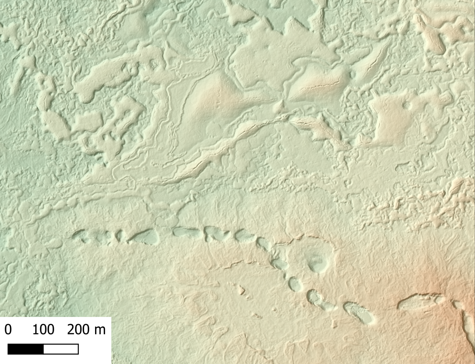
Ingmar Nitze · @i_nitze
108 followers · 102 posts · Server mapstodon.space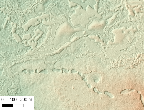
It never gets old.🤩 🤩 🤩
VHR #SfM #DSM from aerial imagery. 10 cm spatial resolution.
Imuruk #lava field in #Alaska.
Processed with #pix4d and #whiteboxtools. Visualized in #QGIS.
#geo #permafrost #arctic
Aerial imagery was captured in July 2021.
#sfm #dsm #lava #alaska #pix4d #whiteboxtools #qgis #geo #permafrost #arctic
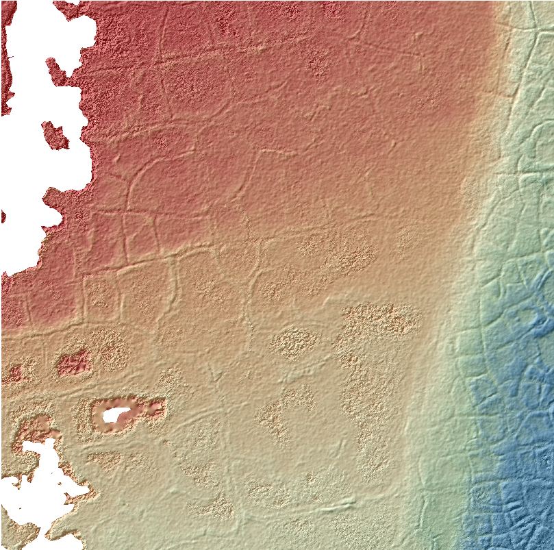
Ingmar Nitze · @i_nitze
73 followers · 52 posts · Server mapstodon.space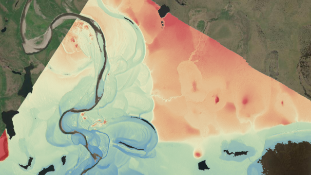
Beautiful #DSM from #S-f-M of aerial imagery in western #Alaska. Processed with #Pix4d and #whiteboxtools.
Kougarok river on the Seward Peninsula south of Last Bridge (North of Nome).
#permafrost polygons
#pingo
beach ridges
#river
drained lake basins
#dsm #s #alaska #pix4d #whiteboxtools #permafrost #pingo #river

Bas Gutwein · @baswein
74 followers · 69 posts · Server mapstodon.spaceI'm very excited about the possibilities of the Mega-Polis #blender plugin that @klixto has been working on. It uses the blender node plugin #Sverchok to bring in and manipulate #GIS data in blender. Already it can utilize #whiteboxtools and #pandas. Can't wait to play with it. Here is a thread on #osarch https://community.osarch.org/discussion/1260/new-plugin-for-blender-sverchok-mega-polis-a-data-driven-urban-design-toolkit-for-sverchok#latest
#blender #sverchok #GIS #whiteboxtools #pandas #osarch

Whitebox Geospatial · @whiteboxgeo
1 followers · 3 posts · Server mstdn.ca
Come join me Dec. 7th to discuss #WhiteboxTools and its applications for topographic analysis. I'm looking forward to seeing you there. #gis #GISChat #geospatial #geomatics #geomophometry
#whiteboxtools #GIS #gischat #GEOSPATIAL #geomatics #geomophometry
Ingmar Nitze · @i_nitze
54 followers · 35 posts · Server mapstodon.space
#DSM + #hillshade #whiteboxtools from #structure-from-motion #pointcloud of aerial imagery.
beautiful #permafrost polygons visible. Output still a bit noisy. Water areas are kept empty (noData)
#dsm #hillshade #whiteboxtools #structure #pointcloud #permafrost

Raf · @Raf
298 followers · 5913 posts · Server mastodon.social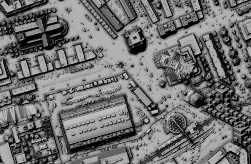
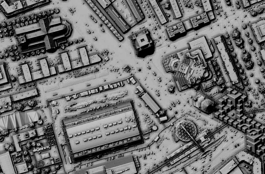
RT @hansakwast@twitter.com
Trying the LidarDigitalSurfaceModel algortithm of #whiteboxtools to interpolate #AHN3 #LiDAR #opendata of #Rotterdam in #QGIS to a raster DSM. Hillshade blended with result from ambient occlusion tool from Terrain Shading plugin. It nicely worked for #kubuswoningen.
🐦🔗: https://twitter.com/hansakwast/status/1405146111191490561
#whiteboxtools #AHN3 #lidar #opendata #rotterdam #qgis #kubuswoningen