Should Be Writing · @DontMindMe
727 followers · 282 posts · Server zirk.us#FuckCars action item from #Saratoga, #WY: A public discussion on the city’s new Master Plan for pedestrian and bike trails, parks and roads will be held on Sept. 13.
"Bring ideas, concerns, hopes and dreams for better transportation alternatives in Saratoga.”
#WarOnCars #TheWarOnCars #autofrei #Urbanism #CarBrain #BikeTooter #cycling #WalkableCities #StrongTowns #TaylorSwift #PublicTransit #PublicTransportation #Wyoming #AutofreiWY #Cheyenne #Yellowstone
#FuckCars #saratoga #wy #waroncars #TheWarOnCars #Autofrei #urbanism #CarBrain #BikeTooter #cycling #walkablecities #strongtowns #taylorswift #publictransit #PublicTransportation #wyoming #autofreiwy #Cheyenne #yellowstone
EAS Watcher · @easwatch
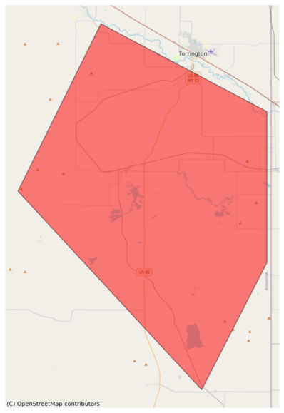
361 followers · 12737 posts · Server m.ai6yr.org#EAS for Goshen, #WY: National Weather Service: SEVERE THUNDERSTORM WARNING in effect for this area until 12:30 AM MDT for DESTRUCTIVE baseball size hail. Take shelter in a sturdy building, away from windows. People and animals outdoors will be severely injured. Source: NWS Cheyenne WY** DO NOT RELY ON THIS FEED FOR LIFE SAFETY, SEEK OUT OFFICIAL SOURCES ***
EAS Watcher · @easwatch
361 followers · 12736 posts · Server m.ai6yr.org#EAS for Goshen, ##WY: National Weather Service: SEVERE THUNDERSTORM WARNING in effect for this area until 12:30 AM MDT for DESTRUCTIVE baseball size hail. Take shelter in a sturdy building, away from windows. People and animals outdoors will be severely injured. Source: NWS Cheyenne WY** DO NOT RELY ON THIS FEED FOR LIFE SAFETY, SEEK OUT OFFICIAL SOURCES ***
EAS Watcher · @easwatch
361 followers · 12736 posts · Server m.ai6yr.orgEAS Watcher · @easwatch
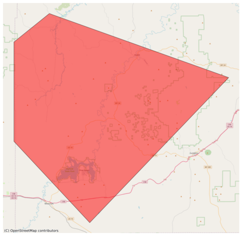
315 followers · 8228 posts · Server m.ai6yr.org#EAS for Campbell, #WY; #Crook, #WY: National Weather Service: SEVERE THUNDERSTORM WARNING in effect for this area until 6:30 PM MDT for DESTRUCTIVE baseball size hail. Take shelter in a sturdy building, away from windows. People and animals outdoors will be severely injured. Source: NWS Rapid City SD** DO NOT RELY ON THIS FEED FOR LIFE SAFETY, SEEK OUT OFFICIAL SOURCES ***
EAS Watcher · @easwatch
315 followers · 8227 posts · Server m.ai6yr.org#EAS for Campbell, ##WY; ##Crook, ##WY: National Weather Service: SEVERE THUNDERSTORM WARNING in effect for this area until 6:30 PM MDT for DESTRUCTIVE baseball size hail. Take shelter in a sturdy building, away from windows. People and animals outdoors will be severely injured. Source: NWS Rapid City SD** DO NOT RELY ON THIS FEED FOR LIFE SAFETY, SEEK OUT OFFICIAL SOURCES ***
EAS Watcher · @easwatch
315 followers · 8227 posts · Server m.ai6yr.orgEAS Watcher · @easwatch
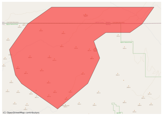
315 followers · 8227 posts · Server m.ai6yr.org#EAS for Big Horn, #MT; #Sheridan, #WY: National Weather Service: A FLASH #FLOOD WARNING is in effect for this area until 7:30 PM MDT. This is a dangerous and life-threatening situation. Do not attempt to travel unless you are fleeing an area subject to flooding or under an evacuation order. Source: NWS Billings MT** DO NOT RELY ON THIS FEED FOR LIFE SAFETY, SEEK OUT OFFICIAL SOURCES ***
EAS Watcher · @easwatch
315 followers · 8227 posts · Server m.ai6yr.org#EAS for Big Horn, ##MT; ##Sheridan, ##WY: National Weather Service: A FLASH #FLOOD WARNING is in effect for this area until 7:30 PM MDT. This is a dangerous and life-threatening situation. Do not attempt to travel unless you are fleeing an area subject to flooding or under an evacuation order. Source: NWS Billings MT** DO NOT RELY ON THIS FEED FOR LIFE SAFETY, SEEK OUT OFFICIAL SOURCES ***
EAS Watcher · @easwatch
315 followers · 8227 posts · Server m.ai6yr.orgBakersRelay · @BakerRL75
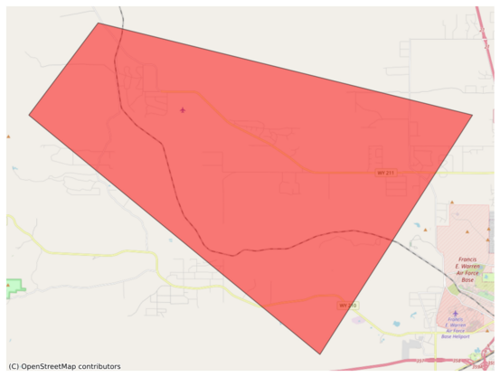
777 followers · 31809 posts · Server m.ai6yr.org#EAS for Laramie, #WY: National Weather Service: #TORNADO WARNING in this area until 4:15 PM MDT. Take shelter now in a basement or an interior room on the lowest floor of a sturdy building. If you are outdoors, in a mobile home, or in a vehicle, move to the closest substantial shelter and protect yourself from flying debris. Check media. Source: NWS Cheyenne WY** DO NOT RELY ON THIS FEED FOR LIFE SAFETY, SEEK OUT OFFICIAL SOURCES ***
EAS Watcher · @easwatch
306 followers · 7990 posts · Server m.ai6yr.org#EAS for Laramie, #WY: National Weather Service: #TORNADO WARNING in this area until 4:15 PM MDT. Take shelter now in a basement or an interior room on the lowest floor of a sturdy building. If you are outdoors, in a mobile home, or in a vehicle, move to the closest substantial shelter and protect yourself from flying debris. Check media. Source: NWS Cheyenne WY** DO NOT RELY ON THIS FEED FOR LIFE SAFETY, SEEK OUT OFFICIAL SOURCES ***
BakersRelay · @BakerRL75
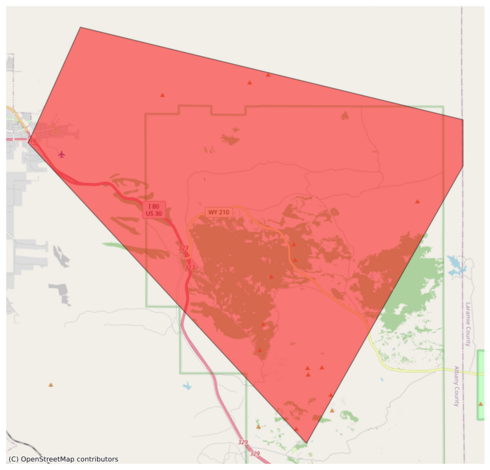
777 followers · 31809 posts · Server m.ai6yr.org#EAS for Albany, #WY: National Weather Service: #TORNADO WARNING in this area until 3:30 PM MDT. Take shelter now in a basement or an interior room on the lowest floor of a sturdy building. If you are outdoors, in a mobile home, or in a vehicle, move to the closest substantial shelter and protect yourself from flying debris. Check media. Source: NWS Cheyenne WY** DO NOT RELY ON THIS FEED FOR LIFE SAFETY, SEEK OUT OFFICIAL SOURCES ***
EAS Watcher · @easwatch
306 followers · 7987 posts · Server m.ai6yr.org#EAS for Albany, #WY: National Weather Service: #TORNADO WARNING in this area until 3:30 PM MDT. Take shelter now in a basement or an interior room on the lowest floor of a sturdy building. If you are outdoors, in a mobile home, or in a vehicle, move to the closest substantial shelter and protect yourself from flying debris. Check media. Source: NWS Cheyenne WY** DO NOT RELY ON THIS FEED FOR LIFE SAFETY, SEEK OUT OFFICIAL SOURCES ***
EAS Watcher · @easwatch
283 followers · 7679 posts · Server m.ai6yr.org#EAS for Campbell, #WY; #Crook, #WY: National Weather Service: SEVERE THUNDERSTORM WARNING in effect for this area until 8:15 PM MDT for DESTRUCTIVE baseball size hail. Take shelter in a sturdy building, away from windows. People and animals outdoors will be severely injured. Source: NWS Rapid City SD** DO NOT RELY ON THIS FEED FOR LIFE SAFETY, SEEK OUT OFFICIAL SOURCES ***
EAS Watcher · @easwatch
283 followers · 7679 posts · Server m.ai6yr.orgBakersRelay · @BakerRL75
757 followers · 27625 posts · Server m.ai6yr.org#EAS for Goshen, #WY; #Niobrara, #WY: National Weather Service: A FLASH #FLOOD WARNING is in effect for this area until 9:30 PM MDT. This is a dangerous and life-threatening situation. Do not attempt to travel unless you are fleeing an area subject to flooding or under an evacuation order. Source: NWS Cheyenne WY** DO NOT RELY ON THIS FEED FOR LIFE SAFETY, SEEK OUT OFFICIAL SOURCES ***
#wywx #EAS #wy #niobrara #flood
EAS Watcher · @easwatch
277 followers · 7532 posts · Server m.ai6yr.org#EAS for Goshen, #WY; #Niobrara, #WY: National Weather Service: A FLASH #FLOOD WARNING is in effect for this area until 9:30 PM MDT. This is a dangerous and life-threatening situation. Do not attempt to travel unless you are fleeing an area subject to flooding or under an evacuation order. Source: NWS Cheyenne WY** DO NOT RELY ON THIS FEED FOR LIFE SAFETY, SEEK OUT OFFICIAL SOURCES ***
EAS Watcher · @easwatch
277 followers · 7531 posts · Server m.ai6yr.orgEAS Watcher · @easwatch
271 followers · 7318 posts · Server m.ai6yr.org#EAS for Scotts Bluff, #NE; #Goshen, #WY: National Weather Service: SEVERE THUNDERSTORM WARNING in effect for this area until 3:45 PM MDT for DESTRUCTIVE 80 mph winds. Take shelter in a sturdy building, away from windows. Flying debris may be deadly to those caught without shelter. Source: NWS Cheyenne WY** DO NOT RELY ON THIS FEED FOR LIFE SAFETY, SEEK OUT OFFICIAL SOURCES ***
